The Fire Safe Council of Nevada County in cooperation with the Allstate Foundation, County of Nevada and the National Firewise Communities Association are offering residents in Nevada County free defensible space advisory visits to educate citizens about Defensible Space. Complete your visit in October or November and get a 2014 Firewise Calendar.
California Public Resources Code 4291 requires every landowner to “maintain around and adjacent to the building or structure a firebreak made by removing and clearing away, for a distance of not less than 100’ on each side of the building or structure or to the property line, whichever is nearer, all flammable vegetation or other combustible growth”.
In addition, this code allows insurance companies to require
landowners to maintain their vegetation.
We live in a wildland urban interface area which has the potential for catastrophic wildfire.
Receive custom advice about:
Building materials
Fire facts
How to manage the vegetation on your property
Plant species considered “high fire risk”
Proper clearance from structures
Proper signage for your property
Answers to any questions you might have about the defensible space around your structures
And a variety of other helpful information
In addition, you will be provided with referrals for contractors and other resources that could help you achieve your fuel objectives.
The American River Fire continues to burn. Heavy smoke continues in the recent areas that I traveled, Nevada City, Grass Valley, Auburn and Roseville. As of this morning, 14,822 acres have been consumed by fire.
The fire is approximately 10 air miles northeast of Foresthill, CA, in steep, rugged terrain. While the fire is predominantly burning on the Tahoe National Forest within the North Fork of the Middle Fork American River drainage, there is a potential, given changes in weather or fire behavior, for the fire to threaten areas near Foresthill.
Active fire behavior continues on the eastern and southern flanks of the fire. Overnight, crews continued to build hand and dozer line to contain the active fire while evaluating future containment options. Firefighters will mop up and patrol containment line along Deadwood Road and Foresthill Divide Road south to the dozer line. Indirect line construction and mop up will continue down Deadwood Ridge. On the east side near Antoine, Manila and Screwauger Canyons, direct and indirect line construction will continue, with support of retardant drops.
Active fire behavior and roll out of burning material continue to be of concern, and will be closely monitored. Strong, erratic outflow winds and lightning may occur today, as the National Weather Service’s Red Flag Warning remains in effect until 11 p.m. Wednesday.
Active fire behavior in very steep, inaccessible terrain makes preparation of contingency lines critical. Indirect attack is the safest way to manage fire in areas of steep and difficult terrain.
American Fire perimeter August 20, 2013
Please help to keep this blog going
Let us Sell or help you buy your new home or land
John J. O’Dell Realtor® GRI
O’Dell Realty
(530) 263-1091 Email John
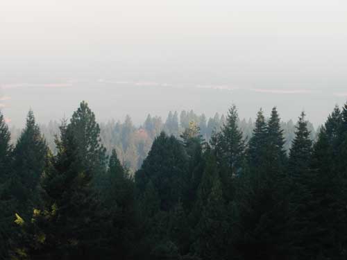
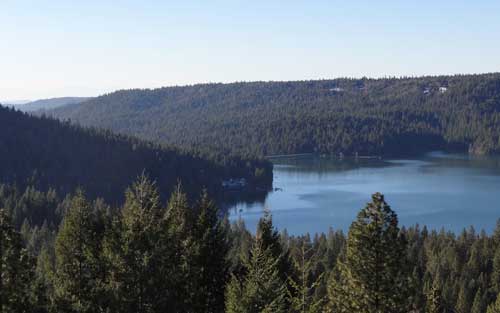
Smoke over Scotts Flat Lake August 13, 2013. Taken from my deck 830 am. Photo Credit John J. O’Dell
The smoke over Scotts Flat Lake was even worse this morning than yesterday. I was smart enough to close my sliding glass doors and turn on the air conditioner during the night. Some of my friends living in Grass Valley left their windows open and woke up to puffed eyes and sore throats.
The American fire is burning in heavy fuels on very steep slopes. The heavy fuels are creating large amounts of smoke The fire is located about 17 miles northeast of Foresthill in the Tahoe National Forest. Access to the fire is limited adding to the difficulty in fighting this fire. Firefighter safety is a concern.
Fire size is estimated at 1750 acres. The fire has burned across the North Fork Middle Fork American River and is burning both up and down the river drainage. The fire is being actively fought both directly and indirectly.
Multiple Forest Service and Cal Fire personnel are assigned to the fire. Currently 318 resources have been assigned including 18 crews, 16 engines, 4 helicopters, 5 dozers, 4 watertenders, and air tankers as available.
The Central Coast #7 Type II Incident Management Team has assumed managment of the fire.
Smoke is expected to impact Foresthill, Auburn, Nevada City, the valley and other areas for several days.
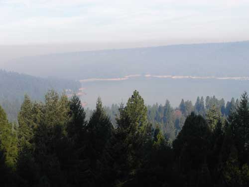
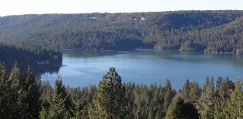
Smoke over Scott’s Flat Lake August 12, 2013. Picture taken by John O’Dell from my deck.
I woke up this morning and looked out my window to discover that Scotts Flat Lake was covered with smoke. Wondering where the fire was and hopefully not near my house, I looked at the Cal-Fire website to determine the location of the fire. Since the fire is in the Tahoe National Forest, I linked from Cal-Fire’s website to InciWeb for farther information
The fire started last Saturday around 4:10 pm. Judy and I were at a wedding in Forest Hill at that time and we noticed smoke in and around Forest Hill.
The American fire is burning in a heavily forested area of very steep terrain on Deadwood Ridge, approximately 17 miles northeast of Forest Hill in Tahoe National Forest. Access to the fire is limited, and firefighter safety is a concern due to difficult terrain.
Fire size is estimated at 800-1,000 acres, with heavy smoke making it difficult to obtain precise numbers. The fire has crossed the North Fork of the Middle Fork of the American River and is burning toward the Last Chance area. Firefighters reported a moderate rate of spread with short uphill runs yesterday, and more of the same is expected today. Firefighters were able to make some progress on line construction overnight.
Multiple Forest Service and Cal Fire engines, crews, dozers, air tankers, and helicopters are committed, with additional resources on order. Smokejumpers are being utilized. Efforts are being focused mainly on the Deadwood Ridge and Last Chance sides of the fire. While firefighters are working to protect cultural resources from the fire and from suppression impacts, firefighter and public safety are the first priorities.
Smoke in the areas of Foresthill, Auburn, Nevada City, and the valley will likely continue over the next several days.
There are no current road closures, but people are being asked to stay out of the fire area for their own safety and the safety of firefighting personnel.
The town of Foresthill is not endangered and there are no evacuations ordered.
Scott’s Flat Reservoir (picture by John J. O’Dell)
Nevada Irrigation District has maintained good levels of reservoir storage and is planning to make normal deliveries this year.
District reservoir levels rose in the near record rains of November and December but the normally wet months of January, February and March brought just eight inches of precipitation to NID mountain watershed.
Official April 1 snow surveys, usually the year’s best indicator of seasonal water supplies, showed just 17% of average water content in a thin mountain snowpack.
Seasonal precipitation at Bowman Reservoir (elevation 5,650 feet) stood at 52.62 inches as of April 10, which equals 87% of average. Seasonal precipitation is measured from July 1 to June 30 on a yearly basis.
April 10 storage in NID’s 10 reservoirs stood at 233,277 acre-feet, which is 93% of capacity and 125% of average for that date.
“Although we’re starting out with well above average water storage, we are expecting below average runoff from the snowpack” said NID Water Operations Administrator Sue Sindt. “This could impact the amount of storage we are able to carry over for 2014”
Sindt said NID will continue a conservative approach in water system operation and is encouraging district customers to eliminate water waste and use water efficiently.
To Contact NID Call (530) 273-6185 or (800) 222-4102
Escaped residential debris burns continue to be a leading cause of fire suppression calls in Nevada County. Learning to safely and cleanly burn vegetation debris helps to minimize smoke emissions and allows firefighters time to respond to true emergencies. It is your responsibility to know and follow local and state burning regulations. Failure to follow these regulations is a misdemeanor offense and you may be fined and prosecuted for the expense of containing a wildfire.
Scotts Flat Reservoir seems to be very close to the spillway elevation which is approximately 3074.8 feet in elevation. That’s the elevation in which the water starts flowing out due to increase in volume from rainfall or from release of water from upper dams. As of today, the elevation of the water is 3073 or about 1.8 feet from flowing over the spillway.
In the pictures above, you can see how close to the top of the dam the water is. Camping, fishing, swimming, sunning, boating, water skiing, sailing, board sailing and other activities are popular at Scotts Flat reservoirs in the Sierra foothills. Day use parks, campgrounds and beaches which is operated by a private operator under contract with Nevada Irrigation District.
Scotts Flat is situated among the tall pines at the 3100-foot elevation nine miles east of Nevada City via Highway 20 and Scotts Flat Road. It offers 169 campsites at two large campgrounds, plus a group camp. Across the lake, accessible via Red Dog and Quaker Hill Roads from Nevada City, is the Cascade Shores Day Use Area.
For all your real estate needs
Email or call today:
John J. O’Dell Realtor® GRI
Civil Engineer
General Contractor
(530) 263-1091
Email jodell@nevadacounty.com
Water supplies to the greater Grass Valley-Nevada City area are safer and more reliable as a result of NID’s Banner Cascade Pipeline Project which is being phased into operation this fall and winter. Pipeline construction, roadway overlays and repaving are finished, tree planting and hydroseeding are being completed this fall, and a startup testing program of the large water system is under way.
Major Upgrade
In planning for 10 years and under construction for the past two years, the $41 million upgrade is the largest project completed by NID since the Yuba-Bear Hydroelectric Project was built in 1963-66. The project includes 6.4 miles of large diameter pipeline to carry water across Banner Mountain to NID’s Elizabeth L. George and Loma Rica water treatment plants. It will also make more irrigation water available to the canal water systems of western Nevada County.The overall project includes 5.5 miles of new treated water pipeline and new fire hydrants, making new supplies of safe drinking water available to many Banner Mountain neighborhoods.
An interesting feature near the downstream end of the water project is the plumbing for a future small hydroelectric power station near NID’s Loma Rica Reservoir. The Banner Cascade Pipeline Project is the second phase of a major upgrade to a key water system serving western Nevada County. NID improved the Upper Cascade Canal (east of Red Dog Road) in an $18 million project completed in 2000-2002.
The 2013 Firewise Calendar features native plants.
The Fire Safe Council of Nevada County in cooperation with the Sierra Nevada Conservancy and National Firewise Communities are offering residents in Nevada County free defensible space advisory visits to educate citizens about Defensible Space.
California Public Resources Code 4291 requires every landowner to “maintain around and adjacent to the building or structure a firebreak made by removing and clearing away, for a distance of not less than 100’ on each side of the building or structure or to the property line, whichever is nearer, all flammable vegetation or other combustible growth”.
In addition, this code allows insurance companies to require landowners to maintain the firebreaks.
SACRAMENTO — Attorney General Kamala D. Harris announced the arrest Thursday of four suspects who have been charged with securities fraud, conspiracy and elder abuse for operating a Ponzi scheme that bilked dozens of investors of over $2.3 million.
The arrest declaration alleges that Gold Country Lenders, a real estate company in Grass Valley, engaged in a pattern of theft and fraud-related crimes for more than eight years. Investor funds were used to make interest payments to earlier investors or for projects in which the company’s owner had a financial interest.
“These defendants exploited their personal relationships with these victims and emptied their bank accounts,” Attorney General Harris said. “Schemes that target the elderly are especially heinous, which is why prosecuting fraud and elder abuse needs to remain priorities for law enforcement.”
Philip Lester, 65, and Ellen Lester, 65, who are married, surrendered to custody, and Susan Laferte, 58, and Jonathan Blinder, 58, were arrested on Thursday in Nevada County.
Philip Lester, CEO of Gold Country Lenders, and Laferte, the firm’s CFO, are being charged with 66 felony counts of elder abuse, securities fraud and conspiracy. Laferte is Philip Lester’s sister. They were booked at the the Nevada County Jail, with bail set at $600,000 each.
Ellen Lester is being charged with two felony counts of conspiracy and securities fraud and was booked at the Nevada County Jail with bail set at $50,000. Blinder is charged with four felony counts of securities fraud and was booked at the Nevada County Jail and released on bail.
From January 2003 to June 2011, Gold Country Lenders sold securities on specific real estate development projects, promising investors annual returns of 8 to 12 percent. These investments were supposedly secured by a first or second deed of trust on the property. In fact, some of the promised deeds of trust were never recorded, while others were recorded but subordinate to other loans, or were diluted by the repackaging and overselling of shares.
In October 2010, the Attorney General’s Office launched an investigation in response to complaints filed by numerous investors.
The arrest affidavit alleges that investors were not told that Philip Lester had a partnership interest in some of the development projects he sold to investors, or that some of the land targeted for development had significant toxic waste issues. Many of the victims are elderly and had known and trusted the defendants for many years.
Unbeknownst to investors, their investment funds were used to make interest payments to earlier investors or for purposes other than the development project they had invested in. For example, victims’ funds were diverted to purchase and operate the Auburn Valley Country Club, a prestigious golf course and clubhouse where the Lesters resided.
Agencies that assisted in serving today’s arrest warrants include the Grass Valley Police Department, the Nevada County Sheriff’s Office, the Riverside County Sheriff’s Office and the Department of Corporations.
“Protecting consumers and investors is at the forefront of the Department of Corporation’s mission,” said California Corporations Commissioner Jan Lynn Owen. “The Department of Corporations works diligently to strongly enforce and uphold California’s financial laws to the fullest extent.”
The Attorney General Office’s Special Crimes Unit conducted the investigation. The case will be prosecuted by the Attorney General’s Mortgage Fraud Strike Force, which was formed in May 2011 to investigate and prosecute crimes related to mortgage, foreclosure and real estate fraud.
Copies of the complaint and arrest declaration are attached to the electronic version of this release atwww.oag.ca.gov