Tag Archives: Nevada Irrigation District

The Mad Russian of Texas Creek

Source Nevada Irrigation District

One of the most colorful characters in Nevada Irrigation District’s history is the legendary “Mad Russian” of Texas Creek.  The solitary but likeable emigrant loved his vodka and garlic, talked to the animals and even kept a pet skunk during 13 years as a ditch tender at the isolated mountain station.

Born in Russia, Walter Proscurin found his way to the Gold Country and held a few odd jobs before he hired on with NID in the early 1950s. He worked summers in the mountains repairing canals and flumes.

Walter’s unusual life in the high country was traced through interviews with NID retirees Jason Davis, Frank “Snowshoe Fritz” Plautz, Lee Droivold and Kent Pascoe.

A year around employee was needed at Texas Creek, four miles southwest of Bowman Reservoir, and it was at the onset of the record setting winter of 1952 when Walter began his career as a high country ditch tender.

“I remembered him calling for help because there was so much snow pushing against his house. He thought the snow would push it into the creek,” said Davis.  Davis used to pack supplies into NID’s remote mountain stations.

Asked what he remembered most about the Russian, DAvis lauged, ” He used to take garlic with his vodka.  You couldn’t get within six miles of him”


“He ate garlic like we eat bread,” added Plautz, who retired after 22 years as NID’s Bowman lake tender. “He was serious.  He wasn’t much for joking. But he was a good-hearted guy. He always wanted to do something for your”

Frank’s wife Ramona, said Walter was very eccentric and may have gained his nickname of the Mad Russian because of the way he would wave a rifle and chase hunters out of the Texas Creek area.

Walter lived alone in a stone and wood cabin on the bank of the Bowman-Spaulding Canal near its crossing at Texas Creek. A foundation is all that remains of the cabin today.

The stout naturalized U.S. citizen, stood about 5′ 10″ and weighed 220 ponds, was responsible for keeping the water flowing through several miles of canals and old wooden flumes from Windy Point to the Clear Creek Tunnel.

Pascoe said the Russian was a big hit during his ventures into Nevad City. “He used to throw himself birthday parties at a Nevada City bar. One year, he must have spent $500 to $700 buying everyone drinks.

He loved animals and he would feed the coyotes. He had a bear coming up there for a few years. He always kept a salt lick for the deer.. He fed the birds and kept a pet skunk und the house.

The 63 year old Russian died on March 24, 1968. The cause of death was listed as heart problems and pneumonia and died alone. He is buried in the Pine Grove Cemetery in Nevada City.

Source: NID Waterways, Summer 2016

Help keep this blog going
Call John O’Dell
O’Dell Realty
BRE 00669941

Error: Contact form not found.


Scotts Flat Reservoir Lake Level September 2014

Scotts Flat Reservoir

Scotts Flat Reservoir
Picture 1 of 9

Scotts Flat Reservoir


Pictures  by John J. O’Dell from my deck.

The water level in the lake is down further than I’ve seen since I’ve lived in Cascade Shores, or at least it seems that way.  Scotts Flat Lake or should I say reservoir, what’s the difference?  A lake is a body of water but a  reservoir is different because it’s level is deepest at the dam and some other technicalities . Oh, well, I still like to call it a lake.  If you really want to know the difference between a lake and reservoir go to Lakes & Reservoirs.

If you want to see the projected water level for Scotts Flat Reservoir  that was prepared by Nevada Irrigation District, go to picture 5.  I’m guessing from my pictures and the graph for water levels for Scotts Flat Lake that the present elevation is around 3,036 foot elevation. The high appears to be 3,062  feet in elevation.  That’s a 26 foot drop which cuts the water storage in half, from 40,000 acre feet to 25,000 acre feet. An acre foot is one foot of water over one acre of land or 43,560 cubic feet of water.

Scott’s Flat is situated among the tall pines at the 3100-foot elevation nine miles east of Nevada City via Highway 20 and Scott’s Flat Road. It offers 169 campsites at two large campgrounds, plus a group camp. Across the lake, accessible via Red Dog and Quaker Hill Roads from Nevada City, is the Cascade Shores Day Use Area. As you can see from my pictures, there a lot of trees around the reservoirs, oops lake.

Please help to keep this blog going
Let us Sell or help you buy your new home or land

John J. O’Dell Realtor® GRI
O’Dell Realty
(530) 263-1091
Email John

BRE#00669941

State Drought Action Impacts Nevada Irrigation District Water Diversions

Scott's Flat Lake. Picture taken from my deck.  John O'Dell
Scott’s Flat Lake. Picture taken from my deck. John O’Dell

GRASS VALLEY – The water rights used by the Nevada Irrigation District to fill reservoirs and supply customers in Nevada and Placer counties are among those covered in the state’s May 27 curtailment order.

To address record dry conditions in California, the State Water Resources Control Board ordered some 2,600 agencies to stop diverting water from streams and rivers, including those on the Yuba River watershed.

NID Manager of Water Operations Chip Close said the district is reviewing its options. “This is another reminder of how serious the drought has become,” he said.

“Everyone has to conserve water. The governor has called for 20 percent water use reductions and we are asking our customers for the same.”

The state’s order includes 19 of NID’s post-1914 water rights, which are also referred as “junior” water rights. NID also holds multiple pre-1914 “senior” water rights, some of which date to the Gold Rush and are among the oldest in the state.

The state’s order does not impact pre-1914 water rights but includes a warning that these rights could be affected if the serious drought conditions continue. The order is effective until drought conditions ease.

Close said that considering the length and severity of the drought, NID is relatively well-prepared.

“We had an early runoff from the snowpack this year so the water is already in our reservoirs,” he said. “Under the state’s order, we’ll have to let any additional runoff run through our system.”

State officials said the action is necessary because current water supplies are insufficient to meet the needs of Sacramento and San Joaquin river water right holders. Affected agencies must certify that they are in compliance or face fines of $1,000 per day. The order allows some exceptions for health and safety purposes.

Close said NID has been carefully managing runoff as dry conditions have continued, leaving district reservoirs at near-average levels for this time of year. The district remains concerned over carryover storage for next year, he said.

Source: Nevada Irrigation District


Please help to keep this blog going
Let us Sell or help you buy your new home or land

John J. O’Dell Realtor® GRI
O’Dell Realty
(530) 263-1091
Email John

BRE#00669941

Enhanced by Zemanta

Nevada County to Have Normal Deliveries of Water For 2013

Scotts-5-2013-Jan

Scott’s Flat Reservoir  (picture by John J. O’Dell)

Nevada Irrigation District has maintained good levels of reservoir storage and is planning to make normal deliveries this year.

District reservoir levels rose in the near record rains of November and December but the normally wet months of January, February and March brought just eight inches of precipitation to NID mountain watershed.

Official April 1 snow surveys, usually the year’s best indicator of seasonal water supplies, showed just 17% of average water content in a thin mountain snowpack.

Seasonal precipitation at Bowman Reservoir (elevation 5,650 feet) stood at 52.62 inches as of April 10, which equals 87% of average.  Seasonal precipitation is measured from July 1 to June 30 on a yearly basis.

April 10 storage in NID’s 10 reservoirs stood at 233,277 acre-feet, which is 93% of capacity and 125% of average for that date.

“Although we’re starting out with well above average water storage, we are expecting below average runoff from the snowpack” said NID Water Operations Administrator Sue Sindt.  “This could impact the amount of storage we are able to carry over for 2014”

Sindt said NID will continue a conservative approach in water system operation and is encouraging district customers to eliminate water waste and use water efficiently.

To Contact NID Call (530) 273-6185 or (800) 222-4102

Source: Nevada Irrigation District.


For all your real estate needs
Email or call today:

John J. O’Dell Realtor® GRI
Civil Engineer
General Contractor
(530) 263-1091
Email jodell@nevadacounty.com

DRE#00669941

Enhanced by Zemanta

Nevada Irrigation District Water Lines Extended to Rattlesnake Road

NID employees Chad Garvey, left, and Andrew Browning prepare to install a new water meter along Rattlesnake Road near Grass Valley

GRASS VALLEY  –  Treated water is now available in the Rattlesnake Road-Wheeler Cross Road area near Grass Valley, following a water line extension project completed this month by the Nevada Irrigation District.

NID and area property owners shared costs in extending a 16-inch main line from Dog Bar Road, across Wheeler Cross Road to the Rattlesnake Road intersection and 1000 feet north on Rattlesnake Road.

The job, with about 3000 feet of new pipe and three new fire hydrants, was completed for NID by C&D Contractors, Inc. of Nevada City.   New pavement overlay has been added throughout the project area.

Chip Close, NID’s interim water operations manager, said the project progressed rapidly through planning, design and construction after contracts were signed with participating property owners.  ”Our new customers were receiving water within nine months,” he said.  ”Our contractor was able to take advantage of the dry weather and good working conditions this winter.”

Officials said the new pipeline is part of the district’s master plan and can eventually be extended across Rattlesnake Road to existing pipelines near Highway 174, depending on public demand.

District maintenance crews are now installing new water meters at the 13 parcels that participated in the water line extension project.

Area residents with questions about NID water public water supplies may contact NID Business Coordinator Shannon Matteoni at (530) 273-618

For all your real estate needs
Email or call today:

John J. O’Dell Realtor® GRI
Civil Engineer
General Contractor
(530) 263-1091
Email jodell@nevadacounty.com

DRE#00669941

Enhanced by Zemanta

Nevada Irrigation District’s Water System Upgraded

A 1952 snowstorm damaged NID’s Cascade Canal. NID's water supply is much stronger and real Canal. NID's water supply is much more reliable.
A 1952 snowstorm damaged NID’s Cascade Canal.   Today,  NID’s water supply is much stronger and  is much more reliable.

Source: Nevada Irrigation District

Water supplies to the greater Grass Valley-Nevada City area are safer and more reliable as a result of NID’s Banner Cascade Pipeline Project which is being phased into operation this fall and winter. Pipeline construction, roadway overlays and repaving are finished, tree planting and hydroseeding are being completed this fall, and a startup testing program of the large water system is under way.

Major Upgrade

In planning for 10 years and under construction for the past two years, the $41 million upgrade is the largest project completed by NID since the Yuba-Bear Hydroelectric Project was built in 1963-66. The project includes 6.4 miles of large diameter pipeline to carry water across Banner Mountain to NID’s Elizabeth L. George and Loma Rica water treatment plants. It will also make more irrigation water available to the canal water systems of western Nevada County.The overall project includes 5.5 miles of new treated water pipeline and new fire hydrants, making new supplies of safe drinking water available to many Banner Mountain neighborhoods.

An interesting feature near the downstream end of the water project is the plumbing for a future small hydroelectric power station near NID’s Loma Rica Reservoir. The Banner Cascade Pipeline Project is the second phase of a major upgrade to a key water system serving western Nevada County. NID improved the Upper Cascade Canal (east of Red Dog Road) in an $18 million project completed in 2000-2002.

For all your real estate needs
Email or call today:

John J. O’Dell Realtor® GRI
Civil Engineer
General Contractor
(530) 263-1091
Email jodell@nevadacounty.com

DRE#00669941

Enhanced by Zemanta

Volunteer To Remove Scotch Broom In March 2012

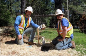
Volunteer Now and help control scotch broom and join the Scotch Broom Challenge in Nevada County.

The Scotch Broom Challenge was created in 2007 to address the spread of this highly flammable and invasive plant in our community. The Scotch Broom Challenge started with just a few sites in Nevada County. In the spring of 2011 over 250 volunteers took the Scotch Broom Challenge and pulled broom at 17 sites throughout Nevada County and Placer County.

This year local groups and agencies are once again teaming up to pull Scotch broom at the sites listed below and we are looking for volunteers from the community who want to come out and join us. The Scotch Broom Challenge pulls are generally from 9 am to 12 pm, unless otherwise stated. No experience is necessary and we provide the equipment and supplies.


Saturday, March 3, 2012 & March 4, 2012

Champion Mine Road

Greater Champion Mine Neighborhood Association

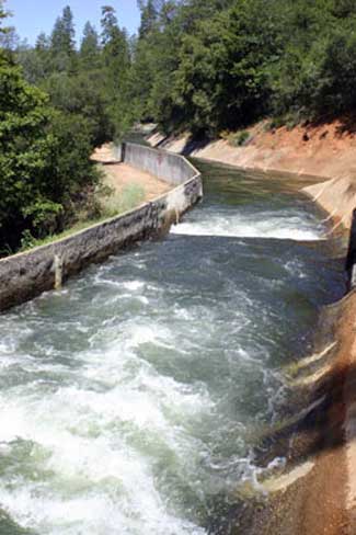
Work continues along Champion Mine Road sponsored by the Greater Champion Mine Neighborhood Association. Nevada Irrigation District is now collaborating on removal of broom in the ditch. The work parties are both days. Project site coordinator is Frances Jorgensen. Please register with the Fire Safe Council of Nevada County to volunteer on this site or any other site.

Saturday, March 3, 2012

Burton House

Bear Yuba Land Trust

Located on Lake Vera Purdon Rd in Nevada City, this preserve is owned by the Bear Yuba Land Trust. The approx 40 acre site is home to a community garden, Food Love Project, a Maidu educational center complete with bark huts and an outdoor education program led by Rick Berry and his Fox Trotters. Project coordinator Allison Dawson. Please register with the Fire Safe Council of Nevada County to volunteer on this site or any other site.

Saturday, March 10, 2012

Tyler Foote Road, North San Juan

North San Juan Fire protection District

Help make one of the primary evacuation routes for the North San Juan Ridge area safe, along Tyler Foote Road, starting near the Fire Station that would be used as a key staging area during a fire. A great chance to learn how to remove Scotch broom effectively. Project site coordinators are Jo Ann and Rusty Kauffman. Please register with the Fire Safe Council of Nevada County to volunteer on this site or any other site.

Saturday, March 10, 2012

Hell’s Half Acre

Red Bud Chapter CNPS

Work continues to remove broom from Hell’s Half Acre which is a unique biological site and is currently used by the Red Bud Chapter of the California Native Plant Society for education and restoration of native plant species. This site is located immediately adjacent to Twin Cities Church off the Rough & Ready Highway just outside Grass Valley. Volunteers are meeting on the corner of Adam Ave and Rough & Ready Hwy. This project site is sponsored by the Red Bud Chapter of CNPS. Project site coordinators is Bill Wilson. Please register with the Fire Safe Council of Nevada County to volunteer on this site or any other site a week in advance.

Saturday, March 10, 2012

North Star Mine House

Bear Yuba Land Trust

Located on Auburn Road just beyond the Fairgrounds, the North Star House in owned by the Bear Yuba Land Trust and hosts a variety of events including a weekly summer Grower’s Market and the Stars at North Star Concert. Project coordinator Allison Dawson. Please register with the Fire Safe Council of Nevada County to volunteer on this site or any other site.


Saturday, March 17, 2012

he Scotch Broom Challenge was created in 2007 to address the spread of this highly flammable and invasive plant in our community. The Scotch Broom Challenge started with just a few sites in Nevada County. In the spring of 2011 over 250 volunteers took the Scotch Broom Challenge and pulled broom at 17 sites throughout Nevada County and Placer County.

This year local groups and agencies are once again teaming up to pull Scotch broom at the sites listed below and we are looking for volunteers from the community who want to come out and join us. The Scotch Broom Challenge pulls are generally from 9 am to 12 pm, unless otherwise stated. No experience is necessary and we provide the equipment and supplies.

Bring your family and friends, pick a site and participate in one of Nevada County’s most fun and satisfying challenges.


Oak Tree Park, North San Juan

Oak Tree Park District

New work was begun last year at the site of the Oak Tree community park. Work will continue at this site in order to control the existing broom and reclaim land lost to dense infestations. This site is sponsored by the Oak Tree Park District. The project site coordinator Grant Wayman. Please register with the Fire Safe Council of Nevada County to volunteer on this site or any other site.

Saturday, March 24, 2012

Wolf Creek at Wolf Creek Road

Wolf Creek Community Alliance

This is the Fourth year for this site and we’ve nearly accomplished our goal. We will be addressing re-sprouting from prior pulling efforts. Consideration for re-vegetation of this site is being evaluated. This site is sponsored by the Wolf Creek Community Alliance. Project site coordinator is BJ Schmitt. Please register with the Fire Safe Council of Nevada County to volunteer on this site or any other site.

Saturday, March 24, 2012

Woodpecker

Bear Yuba Land Trust

Woodpecker Wildlife Preserve is located on Banner Mountain just off Gracie Road. It is a 28 acre preserve owned by the Bear Yuba Land Trust. There are public trails on the preserve that are actively used by the community. This preserve overlooks Nevada City and is a wonderful resource for bird watchers, mountain bikers and hiking enthusiasts. The project site coordinator Allison Dawson. Please register with the Fire Safe Council of Nevada County to volunteer on this site or any other site.

For more information or to volunteer please call 530-272-1122 or send an email to info@areyoufiresafe.com


For all your real estate needs:
Call or email today
John J. O’Dell Realtor® GRI
Real Estate Broker
Civil Engineer
General Contractor
(530) 263-1091
Email jodell@nevadacounty.com

DRE #00669941

Enhanced by Zemanta

Scotts Flat Lake Levels 2011


Click on image to enlarge


I’ve watch Scott’s Flat Lake go to being full to the brim to where it’s at now for the winter. The above chart from Nevada Irrigation District shows the water levels during the summer season


scotts-flat-lake-dam

Image 1 of 4

Looking at the dam at Scotts Flat Lake

Click on pictures to enlarge, escape to close.


Thinking of buying or selling?
For all your real estate needs
Email or call:

John J. O’Dell Realtor® GRI
(530) 263-1091
Email jodell@nevadacounty.com

Western Nevada County’s Main Source of Water, Nevada Irrigation District

Nevada Irrigation District Water Source Map

Nevada Irrigation District  (NID) water originates in the snow pack of a 70,000-acre watershed in the high mountains of Sierra and Nevada counties. The district’s Mountain Division reservoirs include Jackson Meadows, Milton, French, Faucherie, Sawmill and Bowman. Water from these reservoirs flows to PG&E’s Lake Spaulding via the Bowman-Spaulding Canal.

From Spaulding, NID water flows down the South Yuba Canal to the Cascade Canal system which carries water into western Nevada County service areas. Water from Spaulding also flows down the Bear River watershed through PG&E’s Drum Hydroelectric Project and NID’s Yuba-Bear Power Project. This water supplies NID service areas in southern Nevada County and Placer County.

In addition to its seven mountain reservoirs, NID owns and operates three Foothill Division reservoirs, Scotts Flat, Rollins and Combie. The district operates and maintains 400 miles of canals and 300 miles of pipelines.

The highest point on NID watershed is 8373-foot English Mountain, which rises just south of Jackson Meadows. The lowest elevation NID water service is 100 miles to the southwest, at the 150-foot elevation, near Lincoln, Placer County.

Source: Waterways, a publication of NID


Problems making your mortgage payments?
Consider the advantages of a short sale
Call or email today for a free consultation

John J. O’Dell Realtor® GRI
O’Dell Realty
(530) 263-1091
jodell@nevadacounty.com