Tag Archives: Sacramento

Sierra Nevada Snowpack Is Virtually Gone; Water Content Now Is Only 5 Percent of Historic Average, Lowest Since 1950

Scott’s Flat Reservoir Sept 25, 2014. Lowest I’ve seen the reservoir since I’ve lived in Cascade Shores. Picture taken by John J. O’Dell off my deck in Cascade Shores.

 April 1, 2015

SACRAMENTO – The California Department of Water Resources (DWR) found no snow whatsoever today during its manual survey for the media at 6,800 feet in the Sierra Nevada. This was the first time in 75 years of early-April measurements at the Phillips snow course that no snow was found there.

Governor Edmund G. Brown Jr. observed the survey, which confirmed electronic readings showing the statewide snowpack with less water content today than any April 1st since 1950.

Attending the survey with Governor Brown was DWR Director Mark Cowin, who said Californians can expect to receive almost no water from the meager snowpack as it melts in the coming weeks.

“Today’s survey underscores the severity of California’s drought,” he said. “Water conservation must become a way of life during the worst drought in most Californians’ lifetimes.”

Today’s readings are historically significant, since the snowpack traditionally is at its peak by early April before it begins to melt. Electronic readings today found that the statewide snowpack holds only 1.4 inches of water content, just 5 percent of the historical average of 28.3 inches for April 1. The previous low for the date was 25 percent in 2014 and 1977.

The Phillips snow course, which has been surveyed since 1941, has averaged 66.5 inches in early-April measurements there. Four years ago today, the measured depth at Phillips was 124.4 inches. The deepest April 1st Phillips measurement was 150.7 inches in 1983, and the lowest previously was 1.04 inches in 1988. Photos of previous surveys at Phillips can be found here.Images from today’s survey will be posted at that link as soon as possible.

Electronic readings indicate the water content of the northern Sierra snowpack today is 1.4 inches, 5 percent of average for the date. The central and southern Sierra readings were 1.5 inches (5 percent of average) and 1.3 inches (5 percent) respectively.

Today’s manual survey was the fourth of the season conducted for the news media at the Phillips snow course just off Highway 50 near Sierra at Tahoe Road 90 miles east of Sacramento. When DWR conducted the first three manual surveys on December 30, January 29 and March 3, the statewide water content in the snowpack was 50 percent, 25 percent and 19 percent respectively of the historical averages for those dates. The decline reflects California’s significantly lower precipitation and the warming trend that made this winter the warmest in the state’s recorded history. What precipitation there was fell mostly as rain due to warmer temperatures.

In what were considered normal precipitation years, the snowpack supplied about 30 percent of California’s water needs as it melts in the spring and summer. The greater the snowpack water content, the greater the likelihood California’s reservoirs will receive ample runoff as the snowpack melts to meet the state’s water demand in the summer and fall.

Continue reading Sierra Nevada Snowpack Is Virtually Gone; Water Content Now Is Only 5 Percent of Historic Average, Lowest Since 1950

Troubled Waters On The Delta

Picture courtesy of the California Department of Water Resources
Delta–Picture courtesy of the California Department of Water Resources

– By Bill Wells
The fabulous California Delta is within an hours drive of the Bay Area, yet you will feel you are in a different world.

The Delta is formed by the confluence of two major California rivers; the Sacramento and the San Joaquin, and covers some 500,000 acres in the central part of the state. It is home to 225 species of birds, 54 fish species, and 52 species of mammals. The Delta produces some $2 billion in annual crop revenue.

You can spend years exploring the 1,000 miles of local waterways by boat. If you travel by car, motorcycle, or bicycle, there are hundreds of miles of back roads, villages, and towns to visit.

You can ride on some of the only remaining ferry boats in California. Bird watching, wine tasting, local museums, antique shops, and art galleries are but a few of the points of interest you will encounter.

The Delta is also noted for it’s excellent fishing and duck hunting. The Rio Vista Bass Festival attracts 15,000 fishermen and friends each year It has been in existence.

Unfortunately, all is not well in this treasure we call “The Heart of California”. The State Water Project and the Central Valley Project divert much of the Delta water to Central and Southern California. The lower water flows in the Delta caused by the diversions have contributed to the decline in fish populations and proliferation of invasive plants that have clogged waterways over the last few decades.

Now with the administration’s plans to divert the Sacramento River around the Delta via twin 40 foot diameter tunnels, it is possible that what is left of the Delta will be destroyed.

Many local grass roots organizations have banded together to fight the project and the Environmental Protection Agency wrote a scathing letter to the National Marine Fisheries Service which has sent the California Natural Resource Agency back to the drawing board to modify the plan to make it less harmful to the estuary.

We are hopeful that the tunnels will never be built and that water flows will be restored to a level that will be beneficial to the native fish and plant life. With a finite water supply and an ever increasing population, California needs to look at ways of creating new water – not reallocating it from one area to another.


Bill Wells is the Executive Director of the California Delta Chambers & Visitor’s Bureau and has been active in the fight to preserve and protect the California Delta. He served for two plus years on the Bay Delta Conservation Plan (BDCP) public meeting panel and is currently a member of the Delta Protection Commission Advisory Committee.

Help keep this blog going
Call or write today for all your
real estate needs

John J. O’Dell Realtor® GRI
O’Dell Realty
(530) 263-1091
EMail John O’Dell
BRE#00669941

Error: Contact form not found.

Colonia del Sacramento, Uruguay

a-very-fine-salad

Image 1 of 8

.ight as well start lunch with a great salad

By Judy J. Pinegar

February 16, 2013

John and I needed to see the rest of the town, so we walked around until we found a court of local artisans, and bought some very inexpensive souvenirs. Then we went to the main drag, Avenue General Flores, and deciding we were hungry, we had a fantastic “Ensalada Completa”, see picture. Then off to a Thrifty car rental place, but in this town it was to rent small motorcycles, golf carts and bicycles!! You see them everywhere along with a few cars, but really not much motorized traffic at all, most people walking (by the way we are getting very fit from the stairs and the walking!).

Getting an electric golf cart, we were off to explore the town and surrounding area! The golf cart can go anywhere on the streets for three hours, but then you run out of juice, so they really emphasized getting back in time. First through old town (cobblestone streets, and the golf cart does not have very good springs!) We viewed a museum (pictures not allowed), and took pictures of the lighthouse built in 1845, and ruins of a convent built in 1694 and destroyed by fire in 1704.

Then a picture of the “Calle de los Suspiros” which means the ‘Street of Sighs,”  the place where ladies of the night carried on their trade. What a life and the look of the street was not good, imagine it 200 years ago! I think there were a quite a few sighs.  Next stop was the bus station as tomorrow we are going to Montevideo, Uruguay, the capital of the country.

Then we took off along the beach road. Colonia del Sacramento is on a river, but near the sea. The water is extremely muddy, from the runoff from miles of farmland, didn’t look good to me for a swim, but lots of people were swimming. At the end of a long ride was an old bull fighting ring, in much disrepair. On the way back we visited a museum of sunken ships pirates and recovered treasure (however there were only pictures of the bullion, not a sighting of real gold). But the museum was fun, although hot and stuffy, you got to walk through an old galleon model with all the noises and models of the seamen and pirates at work. Kids would love it.

In the afternoon, as my neck had been hurting since the airplane trip, we hired a great masseuse (Susana Stevens, in case you are ever in Colonia), an hour for 500 Uruguayan pesos, or about $25 US. I feel ever so much better, and we had her come back to do John the next morning before we caught the bus to Montevideo.


View Larger Map

For all your real estate neeeds
Call or email:

John J. O’Dell Realtor® GRI
Civil Engineer
General Contractor
(530) 263-1091
Email jodell@nevadacounty.com

DRE# 00669941

Enhanced by Zemanta

Buenos Aires to Colonia del Sacramento, Uruguay

barca-to-uruguay

Image 1 of 9

Boarding barca (boat) from Buenos Aires to Colonia del Sacramento, Uruguay.

By Judy Pinegar

Feb 13 &14, 2013

After a frustrating morning trying to make reservations in the north eastern part of Argentina, we decided to go to Uruguay.  So a Subte ride downtown and a visit to the Barcobus (Ferry) Terminal and we had two tickets to travel on the ferry to Colonia del Sacramento in Uruguay.

On the way back we visited the park of San Martin, a beautiful park with wild trees and an equestrian monument in bronze on a base of polished granite that does honor to General Jose de San Martin and four major milestones related to South American independence.

The next day, Feb 14 we boarded the barca (ferry) named the Eladia Isabel to Uruguay and three very smooth hours later we were there. There was entertainment, food and beverages and views of islands and container ships. We found a much improved terminal on the Uruguayan side from our last visit, and a short taxi ride got us to the nice hotel.

It was located in a area we remembered from our last visit, and we were hoping the same restaurant down the calle (street) was open… it was and we had a wonderful meal of rack of lamb and a wonderful salad with fresh fruit (see pictures).

Colonia del Sacramento was founded in 1680 by the Portuguese. What still remains, stone houses, streets of cobblestones (sometimes slanted toward the middle so the rain can drain down), old walls that were formerly a fortress in the old part of town are enchanting. And the whole town is filled with trees, just like our Sacramento, California.

View Larger Map
For all your real estate neeeds
Call or email:

John J. O’Dell Realtor® GRI
Civil Engineer
General Contractor
(530) 263-1091
Email jodell@nevadacounty.com

DRE# 00669941

Enhanced by Zemanta

Penn Valley, California

By Judy J. Pinegar

The first residents of the area were the Maidu Indians, who migrated in about 1833 from the Sacramento Valley. The four main areas they lived were the sites now called Bridgeport, Lake Wildwood, Indian Springs and Money Flat. However everything changed with the discovery of gold and the white settlers moved into the area, when Penn Valley became one of the first settlements in the county.


Photo courtesy of the Penn Valley Chamber of Commerce

The name Penn Valley may come from a Madam Penn who is remembered for her determination to make money if hard word would do it. Coming to the area in 1849, she took her turn with her husband carrying dirt to wash and rocking out the gold.  Later she had a 320 acre homestead at the intersection of Squirrel and Grub Creeks, which grew to 700 acres (most of Penn Valley) after being purchased in October 1852.

Early settlement of the area was probably started due to its location on a freight wagon route from Sacramento to mining regions east. Later men gave up their picks for plows and the valley produced fresh meat, fruits and vegetables to miners as far away as Nevada (state). In the late 1800’s the valley was home to a thriving dairy industry. In Western Gateway park is the rebuilt Butter Maker’s Cottage to commemorate the importance of the dairy industry in the area.


Photo Courtesy of Penn valley Chamber of Commerce

Today the valley is still a peaceful place, but continues to gain business opportunities and residential growth. Horses, llamas, deer and wild turkeys all coexist in the area with about 12,000 residents. The Western Gateway Park, Historic Bridgeport and Lake Englebright are all a short drive away.

Photo Courtesy of Penn valley Chamber of Commerce

Lake Wildwood is gated community in the area, off  Highway 20 on Pleasant Valley Road, which now has about 5,000 full time residents. Over half of the residents are retirees, but more and more families are moving in and the average age continues to go down.

Judy J. Pinegar is a writer
Her articles have appeared in many publications


For all your real estate needs
Email or call today:

John J. O’Dell Realtor® GRI
Civil Engineer
General Contractor
(530) 263-1091
Email jodell@nevadacounty.com

DRE#00669941

Enhanced by Zemanta

Kill All the Striped Bass in the Delta – Bay Delta Canal Plan (BDCP) Update

Image via Wikipedia
Image via Wikipedia

By Bill Wells

350 angry striped bass fishermen met with Department of Fish  & Game (DFG) officials at the Portuguese Hall in Rio Vista recently.  Marty Gingras a biologist with the DFG spoke of their plans to eradicate the striped bass due to its predation on the salmon.  The reality, as we have explained before is the striped bass and salmon lived in harmony in the Delta from 1879 until recently when the amount of water exported has increased dramatically.  In recent years both species of fish have declined.  Ironically in 2011 when we had plenty of rainfall and runoff all fish and wildlife in the Delta have rebounded.  Striped bass sportfishing is a huge industry in California with licenses alone bringing in over $12 million per year.  Their plan is to eliminate the striped bass, which will theoretically increase salmon populations, which will build a case to export more water from the Delta and cause further declines in fish populations.

Gingras and the DFG are basically stooges of an organization called Coalition for a Sustainable Delta whose goal is anything but sustaining the Delta.  Their contact Michael Boccadoro appears to be the president of a lobbying organization called The Dolphin Group.  Coincidentally the Coalition for a Sustainable Delta and The Dolphin Group share the same address, 915 L Street in Sacramento.  The judge that ruled in favor of wiping out the striped bass is none other than Oliver Wanger who has ruled in favor of water exporters many times.  You have probably seen Wanger’s name recently when he retired from the bench and shortly thereafter went to work as an attorney for Westlands Water District, a major exporter of Delta water (he has since resigned from the position).  If you think I am trying to write a John Grisham novel about California Water thieves you are wrong.  I could not make this stuff up.  Well, if the Coalition for a Sustainable Delta wants to wipe out the striped bass you can only imagine what the Dolphin Group would like to do to dolphins.

I guess the DFG folks were expecting trouble at the meeting, according to my sources there were no fewer than eight armed game wardens at the gathering.  This is a record number of armed guards for water related meetings I have attended.  Generally even when I have been at meetings attended by department heads they have only had two or three California Highway Patrolmen as bodyguards.

While I was researching this matter I ran across this interesting email from Michael Boccadoro to Lester Snow (former head of the Natural Resources Agency, Joe Grindstaff (a member of the Delta Stewardship Council), and John Moffatt (a member of acting Governor Arnold Schwarzenegger’s staff)  dated June 03, 2010.

“Just wanted to make sure you saw the most recent letter to CDFG on striped bass from NMFS.  Very powerful letter.  Does anyone in the administration think this is a priority and maybe deserves some action? This is going to go public very soon since the lawsuit is being heard next week in (Judge Oliver) Wanger’s court.  Fish and Game does not seem to have their act together.  I would very much like to get a response on this.

It was signed: Michael Boccadoro President, The Dolphin Group 925 L Street, Suite 800

Sacramento, CA 95814 (916) 441-4383

Bill Wells
Bil Wells

Bill is a writer and his articles appear in the  www.yachtsmanmagazine.com


Thinking of buying or selling?
For all your real estate needs
Email or call:

John J. O’Dell Realtor® GRI
(530) 263-1091
Email jodell@nevadacounty.com

Enhanced by Zemanta

A Short History of the California Delta Part 4 of 4

Image 1 of 7

Photos courtesy of Bill Wells

By Bill Wells

Agriculture
Reuben Kercheval is credited with building the first man made levees in the Delta on Grand Island about 1849. They were built from peat and only lasted a few years. In 1850 the Swamp and Overflow act which gave control of these swamplands to the state was enacted. Later the state gave control to the counties and most of the swampland was sold off. The original levees were built upon berms of material that were deposited by floods on the banks of the rivers and sloughs over thousands of years. Some of these natural levees were as much as 25 feet high. Once drained the land was prime agriculture land with fabulous peat soil that was later bagged and sold for gardens. Many early farmers were almost able to recoup the price they paid for the land with their first harvest. Sacramento-San Joaquin levees were built in the mid to late 19th Century to prevent flooding on prime agricultural land. Most of the land was at sea level, and levees were frequently constructed on top of natural dirt barriers that formed along rivers and sloughs. Originally Chinese laborers using hand shovels and wheelbarrows built most of the levees.

The trans-continental railroad was completed in 1869 with its terminus in Sacramento where passengers and goods were transferred from the railroad to the steamers plying the river for the rest of the journey to San Francisco. The railroad brought in many European immigrants from the East Coast over the next few decades.

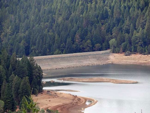
By the turn of the 20th Century, the steam powered clamshell dredge was used to remove material from riverbeds to increase the size of levee barriers. Delta levees are built on sand, silt and peat, which makes them susceptible to erosion, seepage and breaks.

In 1917 Congress authorized the Sacramento Flood Control Project, which was completed by the U.S. Army Corps of Engineers in 1960. “Project levees” built by the Corps were designed to provide superior flood control protection. Once completed, the general upkeep was turned over to local entities. There are over 1600 miles of State-federal project levees in the Central Valley, with about 385 miles located in the Delta. Over a 40-year period about 100 clamshell dredges were used to create the geography in the Delta as we know it today.

In 1927 the bridge over the Straits of Carquinez was completed. This was also the year the majestic steamers Delta King and Delta Queen entered service to Sacramento. The writing was on the wall however and the days of the overnight steamers between Sacramento and Stockton were numbered with the advent of paved highways. There were 300 plus steamers cruising the Delta from 1849 to about 1951. The smaller ones that could ply the smaller rivers and sloughs were called “Mosquito boats” because of the huge clouds of mosquitoes they would attract when their paddle wheels churned the water. The larger ones were floating palaces with elegant food and drink as well as gambling and other activities.

Recreation

As the people of the Delta region became more prosperous they had more time for leisure and pleasure boating. The Sacramento Yacht Club is recognized as the oldest yacht club in the Delta area. The SYC started as the Capital City Boat Club in 1929 but has ties to the Undine Boat Club dating from April of 1870. Originally the club was located on the Sacramento side of the river but eventually moved to its present location on the Yolo side. The oldest yacht club in Northern California is The San Francisco Yacht Club, which began in 1869.

These days the Delta is reported to have “1,000 miles of waterways” but some publications in the 1930s mentioned 1500 miles of waterways. My recollection from the mid-1950s is that by then people were saying 1,000 miles and the late Erle Stanley Gardner mentions in his 1965 book World of water the 1,000 mile figure. That is the earliest written mention I have seen of 1,000 miles. The City of Rio Vista in their publication says 1,100 miles. Hal Schell used the figure of 1,000 miles but was always challenging people to measure the waterways. The Delta Protection Commission reports “635 miles of contiguous waterways”. Whatever the figure, there are plenty of places to visit and explore by pleasure boat and if you have a canoe, kayak or shoreboat there are even more creeks and swamps to explore that larger craft can not enter.

With the advent of the internal combustion engine around the turn of the twentieth century pleasure boats no longer had to rely on oars, sail, or steam for motivational power. Sailing vessels had problems from the time the rivers began silting in around 1870. (Steamboat Slough went from a depth of 15 feet in 1850 to 5 feet by 1870!) Steam vessels generally were larger, expensive and used large amounts of wood or coal for fuel. The gasoline engine so successfully used in automobiles was soon modified for use in boats. This opened boating to a whole new class of people. No longer were power vessels the playthings of the very affluent but were now available to middle class Americans. Small powerboats were ideal for traversing and exploring the Delta with their shallow draft and shorter length they could get into many small backwaters that the larger steamers could not.

Ship and boat construction started early in the Delta area. The first steamer to visit Sacramento was Sitka a 37-foot boat assembled at Yerba Buena (San Francisco) in 1847. Lady Washington was launched in Sacramento in August of 1849. Her owner / skipper was Peter Lassen for whom Mount Lassen was named. (Some accounts say John Sutter was the owner.) She was apparently shipped from the East Coast and assembled in Sacramento). On her maiden voyage she made it all the way to Coloma the site of Marshall’s gold discovery. Unfortunately she hit a snag and sank on the return trip. She was raised and later renamed Ohio and cruised the area until 1868.

Several boat builders made the area their home. The Nunes family were boat builders in the Azores who moved to Sausalito where they founded the famous Nunes boatyard. Along with many other famous yachts they built Zaca a beautiful schooner owned by actor Errol Flynn for several years. Some of the other builders of note in the bay and Delta were Stone Boat Yard, Stephens Brothers, Madden and Lewis, Anderson and Cristofani, Geo. Kneass, Colberg Boat Works, Besotes, and United Ship Repair.

Stephens Brothers began operation in Stockton in 1902. In 1901 two brothers Theodore and Robert Stephens built a 33 foot sloop Dorothy in their back yard on Yosemite Street in Stockton. They sailed the boat from Stockton to Santa Cruz on her maiden voyage. Soon after, they started receiving commissions to build other boats. The neighbors complained about the commercial activity going on in the back yard so the brothers purchased a barge moored in the Stockton Channel to use as a construction site. Within a few years the company was moved to its location at 745 South Yosemite Street where it remained until 1987 when it went out of business. Currently the location is the home of the fine 5 Star Marina operated by the McDonald brothers Bob and Terry. Many of the buildings today look like they did in the heyday of the business. Early on Stephens built quick open runabouts that were called “spud boats”. In 1912 a Stephens spud boat set a speed record from Stockton to San Francisco. They were used by brokers and produce dealers to roam the Delta buying crops. Speed was important, as generally the first buyer to reach a farm would purchase the crop.

These boats later evolved into pleasure boats that were both beautiful and fast. In the winter of 1925 a Siam teak hulled, Scripps powered, 26-foot Stephens runabout ran from San Francisco to San Diego in less than 24 hours, a record time. For the next several years the 26-foot runabouts carried the company financially. In 1929 Stephens started producing stock cruiser hulls which could be customized to the owner’s requirements. These would allow the owner a custom yacht at close to a production boat price. These boats did well and saw the company through the depression. Pleasure boat construction stopped at the outbreak of World War II and yards such as Stephens concentrated on building military vessels for the duration.

Plywood and Fiberglass became popular boat building materials after World War II, which further opened boating to a wider class of boaters. Likewise many war surplus vessels were converted to yachts and placed in service in the Delta. Other boats that had been seized for duty during the war found their way back into private hands, stripped of their gray paint, and varnished once again. The vessel Pat Pending owned by the Owen family of San Francisco which was mounted with a cannon and depth charges during the war and used as a submarine net tender was purchased back from the government, restored to her original beauty and cruises the Bay and Delta today.

The Lauritzens were early pioneers of the Delta. They ran Lauritzen Transportation Company and at one point had a fleet of 8 boats that moved goods and people between the bay and various Delta landings. Today Chris III and his sister Margaret run the business as one of the finest yacht harbors in the Delta located near the Antioch Bridge at the gateway to the Delta.

In 1931 the Korth family purchased land at the confluence of the San Joaquin and Mokelumne Rivers at the very Southern tip of Sacramento County. They originally planned to be farmers and grow asparagus on the property. In 1937, the Korth’s began renting out rowboats for a dollar a day. The following summer in 1938 Albine Korth decided to start building his own rowboats and his rental fleet began to grow. After World War II the Korths purchased more boats at US Government surplus auctions, and so Korth’s Pirate’s Lair as a Delta destination was beginning. During the 1940’s a snack bar was opened which evolved into the current restaurant at Korth’s. Boat sheds were constructed and the harbor was dredged and breakwater built in the 1960’s and Korth’s evolved into the fine marina that it remains today. These days the third generation of the Korth family operates three of the best marinas in the Delta with Korth’s Pirate’s Lair, Oxbow Marina, and Willow Berm Marina.

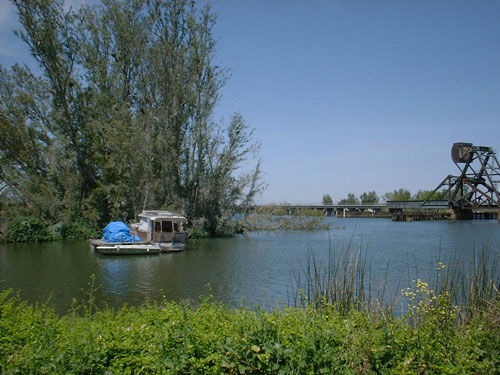
As shipping on the river declined the owners of river ports converted the docks to moor pleasure boats and converted large produce sheds into dry storage for trailer boats. Tower Park marina on Potato Slough and Boathouse Marina on the Sacramento are two examples of this strategy.

Boating expanded greatly in the Delta after the war due to the new low cost materials and the availability of surplus boats at very low prices. Many military vessels were converted to yachts, and people learned how to build a conventional pointed bow onto Higgins landing craft. With a superstructure added and cabins built inside many of these found there way into the Delta as yachts.

At this writing there are about 95 marinas with 11,700 boat slips in the Delta area and every year thousands of other boats are trailered in from all over the West coast and beyond. Many boats visit the Delta from San Francisco Bay and larger yachts travel in from West Coast ports and all over the world.

According to the Delta Protection Commission the Delta area covers about 750,000 acres with about 64,000 acres of urban areas and about 56,000 acres of waterways, and much of the remaining given to agriculture. Recreation opportunities abound with Cruising, sailing, gunkholing, water-skiing, wakeboarding, wind-surfing, camping, hunting, fishing, biking, hiking, and just hanging out all available in the Delta.

The Future

At this writing, there are many pressures on the Delta. Delta waters serves perhaps two-thirds of the population of California (about 20,000,000 legal residents) and most of this population lives in Southern California. One recent study by the University of California made a case for more of salt water intrusion in in the Delta which is supposed to help restore the ecology of the area.

Other plans call for a dam possibly at Carquinez Strait or flooding Delta Islands to store water.  The peripheral canal has reared its ugly head again after lying dormant for many years.  The peripheral canal is a plan to take water out of the Sacramento River well above the Delta, which will drastically reduce the water quality in the Delta.  One thing is known, the next hundred years or so in the Delta will certainly be interesting!

Source:

Bill Wells
Executive Director
California Delta Chambers & Visitor’s Bureau
PO Box 1118
Rio Vista, CA 94571

916-777-4041

Click Here for California Delta Chambers Website

For all your real estate needs call or write:

John J. O’Dell
Real Estate Broker
O’Dell Realty
(530) 263-1091

Email John at jodell@nevadacounty.com

A Short History of the California Delta Part 3 of 4

Early San Francisco from article by Susan Saperstein

Picture from Guide Lines News Letter

By Bill Wells

European Settlement

The Mexican Government surely became concerned about the interlopers ferreting around in their territory and it is believed that this is what led them to grant John Sutter his vast tract at the confluence of the Sacramento and American Rivers.  One of Sutter’s boats was the schooner Isabella which legend has it had been the private yacht of King Kamehameha the Great of the Sandwich Islands, possibly the first yacht in the Delta!  Leaving what is now San Francisco in August of 1839 it took Sutter and his band eight days to find the entrance to the Sacramento after passing through Carquinez Straits which speaks to the maze of waterways even then.  Sutter eventually landed on the bank of the American River at about where the city dump of Sacramento is located.  He built his fort nearby at what is now the corner of 27th and L streets in Sacramento.  Sutter became a Mexican citizen on August 29, 1840 and was appointed Captain in the Mexican Army as well as judge and representative of the “Government at the Frontier of the Rio Sacramento”.  Sutter’s treatment of the Indians is a matter of controversy. Certainly he treated them no worse than did the Mexicans or the Spanish before them. What is known is that he minted tin coins with stars stamped into them for payment to the Indians for work performed and the coins could be redeemed later for food or dry goods in Sutter’s store.

Charles Weber migrated westward and arrived at John Marsh’s ranch at the base of Mt. Diablo in October of 1841.  Weber made his way to Sutter’s fort and was employed there in the winter of 1841.  Sutter sponsored Weber to obtain Mexican citizenship, which made Weber eligible to receive a land-grant from Mexico.  In 1844 Captain Charles Weber and William Gulnac obtained a Mexican land grant for the Rancho del Campo de los Franceses of about 48,000 acres.  Weber later bought out Gulnac for $200 and started the settlement of Slough Town later renamed Tuleburg.

During the Mexican-American war the Mexicans imprisoned Weber for refusing to raise arms against the Americans.  Commodore Robert F. Stockton the American military commander of California rescued him.  In gratitude Weber renamed his settlement Stockton which name it still bears today. The Steamer John A. Sutter was the first power boat to arrive in Stockton on November 1849.

On June 16, 1846 the settlers in California under the command of John Fremont declared independence from Mexico and created the Bear Flag Republic.  On July 11, 1846 Paul Revere’s nephew Lieutenant Joseph Revere sent a United States flag to Sutter and the U.S. annexed California under the Treaty of Guadalupe Hidalgo which included paying Mexico a cash payment of $15,000,000 and the United States assuming claims of American citizens against Mexico of $3,250,000. This ended Mexico’s 21 year control of California.  On September 9, 1850, by act of congress California became the 31st state in the Union.

Gold!

Sutter's Mill - Photo courtesy of Bureau of Ocean Management, Regulation and Enforcement

In January of 1848 James Marshall found gold at Sutter’s sawmill on the American River at Coloma and the news quickly spread to San Francisco in spite of Sutter’s attempt to keep the discovery secret.  The first known newspaper account was on March 15, 1848 in The Californian in San Francisco and from then on the population of Northern California grew exponentially.

Sam Brannan seized the opportunity and opened a store selling mining supplies.  Sam is credited with founding the city of Sacramento and was rumored to have been seen running through the streets of San Francisco yelling “gold has been discovered in the Sierras!”  Brannan was reported as California’s first millionaire.  John Sutter later in 1848 said:”Every little shanty in or around the Fort became a store, a warehouse or a hotel, the whole settlement was a veritable bazaar.”

Captain William Warner and Lieutenant William T. Sherman (later as General Sherman of Civil War fame) surveyed the area between Sutter’s Fort and the Embarcadero along the Sacramento River laying out the first grid of the city that would be known as “Sacramento City”.  Sam Brannan claimed credit for the name.   From Sherman’s memoirs: “ Having finished our work on the Cosumnes, we proceeded to Sacramento, where Captain Sutter employed us to connect the survey of Sacramento City, made by Lieutenant Warner, and that of Sutterville, three miles below, which was then being surveyed by Lieutenant J. W. Davidson, of the First Dragoons. At Sutterville, the plateau of the Sacramento approached quite near the river, and it would have made a better site for a town than the low, submerged land where the city now stands; but it seems to be a law of growth that all natural advantages are disregarded wherever once business chooses a location. Old Sutter’s embarcadero became Sacramento City, simply because it was the first point used for unloading boats for Sutter’s Fort”

Originally the San Joaquin had a myriad of turns and bends and plans to straighten it were formulated in the 1870’s.  The project was finished in the 1930’s by cutting through numerous islands and dredging the channel to 26 feet.  This one project created many new islands and meandering waterways that are still in existence today.

John Bidwell had a 17,700 acre land grant along the Sacramento River starting in 1844 that included the area that now is the City of Rio Vista.  In 1848 at the beginning of the gold rush a wharf was built to handle the steamer traffic.  N.H. Davis purchased the town site from Bidwell in 1855 and by 1860 the town was called Rio Vista.  The great storm of 1861 washed the town away and it was later rebuilt on higher ground where it remains today.  The channel of the Sacramento river originally went through horseshoe bend to the east of Decker Island just downstream from Rio Vista but a cut was made and the channel moved to its present location in 1918 creating Decker Island.

Up until the rivers were silted in by hydraulic mining in the 1870’s steamers could make it all the way up the Sacramento to Red Bluff and up the Feather River as far as Yuba City.  On the San Joaquin steamers made it as far as Firebaugh near Fresno.  There are even records of steamboats going as far as Coloma (!) on the American River.  The hydraulic mining caused terrible silting of the rivers, which is still a major problem today.   The Yuba river near Marysville went from a “fish filled 30-foot (deep) water” in 1850 to where “the river was almost level with Marysville streets” in 1878 according to Marysville mayor at that time C.E. Stone.  The Briggs orchard near Marysville was covered with 20 feet of silt.  In one year in the 1870’s “46 Million cubic yards of gravel, a mass a mile wide and a mile long and fifteen yards deep had been hurled into the streams or spread over the farm lands”.  Over a thirty year period two billion cubic yards of debris filled the Sacramento River and its tributaries.

The gold rush brought hoards of people to Northern California.  Some came overland but many came by sea.  As of March of 1850 Sacramento City had thirty stores, six saloons, and many other business establishments.  By 1855 Sacramento produced $300,000 worth of manufactured items per month.

The name of the settlement of Yerba Buena was changed to San Francisco in 1847.  The original settlement was started at Yerba Buena Cove but as the population and area expanded a new name was thought to be in order.  Gold captivated most people until about 1860 at which time agriculture was rediscovered.  The original farmers were called rimlanders because they farmed on the edges of the Delta before the islands had been surrounded with levees and reclaimed.

Source:

Bill Wells
Executive Director
California Delta Chambers & Visitor’s Bureau
PO Box 1118
Rio Vista, CA 94571

916-777-4041

Click Here for California Delta Chambers Website

For all your real estate needs call or write:

John J. O’Dell
Real Estate Broker
O’Dell Realty
(530) 263-1091

johnodell@nevadacounty.com

A Short History of the California Delta Part 2 of 4

By Bill Wells

European Exploration

Hernando Cortez with his Indian allies seized Mexico in 1519, and in 1521 two of his soldiers deserted and headed north to Alta California possibly because of rumors of great wealth to be found there.  Legend has it that these two were the first Europeans to visit the Great Valley and to view the Sacramento River.  In April of 1879 two miners cutting down an old oak near the Middle Fork of the Feather River found an old manuscript buried inside the tree.  Ten years later in 1889 the miners showed it to a Spanish speaker and the manuscript was translated as the story of the two.  It was shipped to the Naval Museum in Madrid but apparently lost and as of yet has not resurfaced.

A Portuguese, Joao Rodriquez Cabrilho is probably the first European to venture up the California coast and in 1542 discovered San Diego Bay and sailed as far North as Monterey Bay before turning back and dying in an accident at San Miguel Island early in 1543.  The Spanish possibly still smarting that Columbus was Italian corrupted his name to Juan Cabrillo.

Francis Drake was possibly the first European to enter San Francisco Bay and anchored near what is now San Quentin prison in 1579.  (This is in dispute and some say he actually anchored in Drake’s Bay or Bodega Bay or even farther North).  In the 1930’s a brass plaque was discovered near San Quentin purportedly left there by Drake, in the 1990’s it was exposed as a fake.  The description later narratives left of the Indian culture Drake and his crew spent five weeks with is convincingly Coastal Maidu.  The Coastal Maidu inhabited the area from Duncan’s Point on the North Coast to the Northern side of the Golden Gate and included Bodega Bay, Drake’s Bay, and the North Bay area of Sausalito, San Rafael, Petaluma, and Cotati.

Continue reading A Short History of the California Delta Part 2 of 4

A Short History of the California Deta Part 1 of 4

Mt. Diablo from the San Joaquin Bridge

By Bill Wells

The Sacramento / San Joaquin Delta is the largest tidal estuary on the West Coast of the United States.  Technically it is an inverse delta where many waterways combine into one and empty into the sea.  This is the opposite of a delta such as the Mississippi where one or a few waterways expand into many as they reach the sea.

Pre-history

About 140 million years ago the predecessors to the Sierras rose and eroded away giving rise to the present Sierra range.  Later perhaps 1,000,000 years ago the ice ages carved the Markley Gorge, which today lies about 2,000 to 5,000 feet under the floor of the Great Valley (the combined Sacramento and San Joaquin valleys collectively are known as the Great Valley).  As the sediment filled Markley Gorge the current Delta as we know it was created.  As the last ice age receded 10,000 to 12,000 years ago humans wandered down from the northern latitudes and settled the land we know today as California.

Probably the first written reference to the name California was in 1510 in the book: Las Sergas de Esplandin published in Seville and written by Garci Ordonez de Montalvo.  This was a fantasy and spoke of a mythical island in the West Indies populated by Amazons ruled by Queen Califia.  The early Spaniards gave the name to the land lying West of Mexico, which we now know as Baja California.  Originally this was thought to be an island and later the Spanish gave the name to all the territory from Cabo San Lucas to Alaska.

Aboriginal Culture

Indians were the first inhabitants of the central California area. Radio Carbon dating of shell mounds near San Francisco Bay show that the area was inhabited at least 3,000 to 4,000 years ago.  There were 425 recorded shell mounds around the bay and up into Suisun Bay.  These mounds were composed largely of mussel shells but many artifacts and human remains from burials were also found.  Some of these mounds were up to 40 feet high..  The vast majority of the mounds have been destroyed to build parking lots and shopping centers throughout the bay area.  Shellmound Road in Emeryville was so named because of its proximity to a large mound.

At the time the Spanish began exploring California it is estimated that there could have been as many as 250,000 Native Americans in what is now the state.  The Maidu and Miwok groups inhabited the Delta  and its tributary river areas.  In the late 1700’s it is estimated that there were about 9,000 Maidu and about 11,000 Miwoks inhabiting about 1000 square miles of the greater Delta area in the Sacramento and San Joaquin Valleys.

The native cultures in the Delta and bay area used acorns as a dietary staple.  The acorns were gathered, stored and dried, and ground into meal and the acid leached out with water.  There was also a huge abundance of game and fish in the Delta area.  There were many villages in the Delta area and these lent their names to many local features.

These people lived in a Stone Age culture until the Spanish began settling the area with their missions in 1770.   After the missions were established most of the Indians that lived in proximity were either conscripted for labor or fled, many into the Delta area.  A terrible fever probably malaria swept through the Indian population starting in 1833.  Trappers passing through the Sacramento valley in the fall of 1832 reported a large Indian population but when they returned in the summer of 1833 they found only five living Indians between the head of Sacramento valley and the Kings River.  Malaria was probably brought to California by early adventurers, fur traders, and Spanish missionaries beginning in the early 1800’s, and remained epidemic in the Central Valley until the late 1800’s. By 1900 the level of malaria had been greatly reduced by the efforts of many of California’s mosquito control districts.

Tomorrow: Part 2

Source:

Bill Wells
Executive Director
California Delta Chambers & Visitor’s Bureau
PO Box 1118
Rio Vista, CA 94571

916-777-4041

Click for California Delta Chambers Website

For all your real estate needs Call
John J. O’Dell
Real Estate Broker
(530) 263-1091
Email jodell@nevadacounty.com

DRE# 00669941