Tag Archives: State Parks

Empire Mine, Nevada County

httpv://www.youtube.com/watch?v=cLsSzr0qOn0
This is a video prepared for the California Preservation Foundation and was also a history project.

Brief History: The Empire Mine was the richest hard-rock mine in the State of California producing 5.8 million ounces of gold in its operating history of 106 years (1850-1956). George Roberts, the original discoverer of the gold soon sold his interest and by 1869 William Bourn Sr. owned controlling interest. The Bourn family maintained control of the mine until 1929 when it was sold to Newmont Mining. It ceased operation in 1956. In 1975 the State purchased the surface property as the Empire Mine State Historic Park. The Park continues to draw thousands of worldwide visitors each year and is noted for its historical tours of the Bourn Cottage, the mineyard and “living history” events.

Park Attractions: In addition to the tours noted above, the Park museum has a scale model of the underground workings of the Empire/Star mine complex, a “gold room” which displays ore samples from local mines,an Assay Office, and an extensive mineral collection. A video entitled “Tears from the Sun” depicting various gold mining techniques is shown on a regular basis. On Mother’s Day Weekend a Springtime Open House is held .It features the “Living History” programs,food service, and entertainment. As an added bonus the Gardens are in bloom!! The annual Miner’s Picnic is scheduled for late summer and over Thanksgiving weekend the Park sponsors a “Holiday Open-House”. For groups of 25 or more a Miner’s Luncheon is available. For additional information on these events click on the appropriate heading on the “Site Index”. For details on schedules fees click here

Location Map

View Larger Map

Bridgeport Covered Bridge, Nevada County, CA

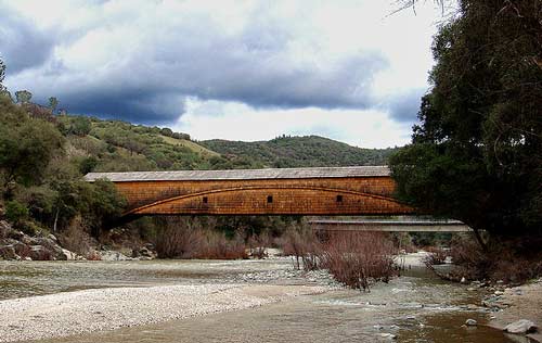
bridgeport-bridge-1

To contact the Bridgeport State Park call (530) 432-2546

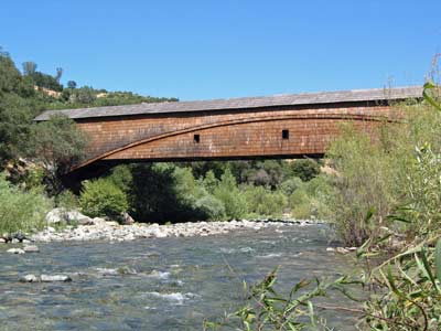
One of the most beautiful bridges in Nevada County, if not in all of the Gold Country is the Bridgeport covered bridge on the South Fork of the Yuba River in the South Yuba River State Park.

The bridge was originally constructed in 1862 and was part of the Virginia Turnpike Company Toll Road that served the northern mines and traffic to and from Virginia City and the Comstock Lode in Nevada. The bridge is 230 feet (70 m) long. Bridgeport Bridge, or “Wood’s Crossing”, is the longest single span covered bridge in existence. Bridgeport Bridge was built as part of a toll road. Toll roads were authorized by the State of California in 1853 as a means to start construction of much needed roads by private companies.

On October 20, 1997, there was a flood on the South Yuba River that almost took the bridge out.  It was 135 years old at the time and workers put in 10 hour days making repairs on the landmark wooden bridge.

More than a century ago, pioneers and miners paid a $2 toll to drive their wagons and horses across a covered wooden bridge over the South Yuba River at Wood’s Crossing. Now, traffic is limited to pedestrians only and there is no toll.

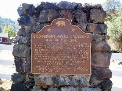
bridgeport-plaque

The historical plague dedicated to the bridge which reads:

Bridgeport (NYE’s Crossing) Covered Bridge

Built in 1862 by David Issac Johnwood with lumber from his mill in Sierra County, This Bridge was part of the Virginia Turnpike Company Toll Road which served the Northern Mines and the busy Nevada Comstock Lode.  Utilizing a combination truss and arch construction, it is one of the oldest housed spans in the west and the longest single span, wood covered bridge in the United States.

California Registered Historical Landmark No. 390

Plaque placed by the California State Park Commission in cooperation with the Nevada County Historical Society and the Wm. B. Meek-Wm. M. Stewart Chapter No. 10, E Clampus Vitus, May 23, 1964

To contact the Bridgeport State Park call (530) 432-2546


View Larger Map

Empire Mine State Park, Nevada County

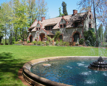
Bourn Cottage
Bourn Cottage

I believe that one of the nuggets of Nevada County is the Empire Mine State Park. Located in Grass Valley, nestled among tall pines, oaks and cedars, it has been brought back to its original grandeur of the mining days of old.

This is really one of the state parks that is a must visit. To mention some of the activities there are 12 miles of beautiful trails for hiking, mountain bike riding and horse back riding. I have ridden my mountain bike on many of the trails and the trails range from flat to very, very steep. Visting the park is like going back in time to the 49’s era, seeing how the miners worked and how the rich mine owners lived.

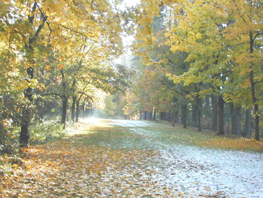
Hardrock Trail - Photo by Jeff Herman

Tours are available inside the Bourn Cottage, as Volunteers in period dress recreate characters from Empire’s colorful past. This two story country home of William Bourn, Jr., styled after the noble estates of nineteenth century England, was built in the late 1890’s. The architecture is distinguished by a remarkable redwood interior, leaded glass windows and massive granite walls. Cottage Living History tours are available every weekend May through mid-October.

A brief history of the mine:

“For more than a century, from 1850 to 1956, the grumblings and rumblings of the stamp mill could be heard for miles around Grass Valley. Twenty-four hours a day, huge banks of machines sent iron rods crashing into chunks of ore blasted from deep inside the Earth. The noise was a constant. Living near the Empire Mine was like living near an interstate highway: You got used to it, or you went nuts.

“People only noticed when it stopped,” says Donna Jones, interpretive ranger at Empire Mine State Historic Park. “And one of the few times it stopped was when Maude Bourn married. They turned it off for three days.”

Maude Bourn was the daughter of William Bowers Bourn Jr., who took over the mine from his father in 1887 and went on to become a big name in California, leaving, among his many legacies, the 43-room Filoli mansion in Woodside and the Greystone Winery (now headquarters for the Culinary Institute of America) in St. Helena.

Empire Mine was one of the first — and eventually the largest and most productive — hard-rock mining operations in California, having its start with the discovery, in 1850, of flecks of gold in an outcropping of quartz where the park’s main parking lot is now. Some 5.8 million ounces were eventually extracted from the vein.

The usual method of entering the mine was aboard a cable-operated “man skip,” which resembled a giant toboggan on tracks. Twenty men at a time would pile on for the rip-roaring, 600-feet-per-minute ride into the bowels of the Earth.

“They always put the new men in front so that, if they lost their breakfast, it wouldn’t affect anyone else,” Jones says dryly.”

Source Sacramento Bee

For more information of the activities, fees and tour dates visit Empire State Park

If you have visited the park, please leave your comments of your impression of the park.


View Larger Map

South Yuba River State Park, Nevada County, California

Bridgeport Covered Bridge, Nevada County, CA

The South Yuba River State Park, located in Nevada County,  is a 20-mile portion of the South Yuba River canyon stretching from Malakoff Diggings State Historic Park to Bridgeport covered bridge. The area includes the longest single-span covered bridge in the world, the steep rugged canyon of the South Yuba River, and the Independence Trail — the first identified wheelchair-accessible wilderness trail in the country.

Bridgeport is the centerpiece of the South Yuba River State Park which is one of only nine covered bridges built in the United States prior to 1900. Built in 1862 at 251 feet, it is still the longest single span covered bridge of its type in the United States. One theory as to why bridges were covered is that they were built of wood, and a covered wooden bridge would last longer. The Bridge is a State and National Historic Landmark.
There are many of things to do in the park:

swimming (Including shallow areas where children under family supervision can swim)
hiking
panning for gold
beautiful wildflowers in the spring
exploring the trails leading to historic mining sites
Docent-led history, nature, and gold-panning tours are also offered at selected times throughout the year.

The State of California Park division is offering gold panning lessons and you can log on to their web site at South Yuba River SP for their schedule.

Either Marya Miller or another birder offers a bird hike on the last Sunday of every month at 9:00 AM. Sitting astride the South Yuba River it is the seasonal home to a considerable variety of birds. The wide variety of avian life found throughout the year at Bridgeport is one of its prime attractions. While incomplete, a list would include several varieties of woodpeckers, swallows, owls, wild turkeys, black phoebes, hummingbirds, warblers, wrens, vireos and a wide variety of raptors, including golden and bald eagles.

Adventuresome hikers have a choice of trails ranging in difficulty from the easiest (Independence Trail), to other more strenuous trails throughout the park

South Yuba River State Park headquarters located at Bridgeport, 17660 Pleasant Valley Rd can be accessed from Highway 20 west of Grass Valley or from Higway 49 north of Nevada City. Remote portions of the park are accessible from Edwards Crossing, Purdon Crossing, and Highway 49.


View Larger Map

Malakoff Diggings State Park

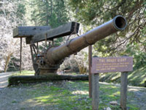
The Hendy Monitor, used to wash the mountains down

With all the bad news lately, it’s time to take a deep breath and think about all of the natural beauties that exist in this County. My friend Judy and I took a trip to Malakoff Diggings a couple of weeks ago. You can go the way we did, from Nevada City on Highway 49, turn right onto North Bloomfield Road, continue on until you come to the park. I prefer this route, with parts of the road steep with many switch backs, cutting across an old bridge over the South Yuba River. You can stop by the bridge and appreciate the wonders of nature and what the force of water can do to a river bed. Then continue on until you get to the park and the town of North Bloomfield.. Interesting, the web site of the State tells you that this route is not recommended. I guess if you are not used to driving in the mountains, it’s not a good way to go, but it is sure a beautiful drive. Google Map

The other way to go, which is a lot faster is to leave Nevada City, travel eleven miles up Highway 49 to left on Tyler Foote Road and continue on to the park. The road changes names several times, but stay on the pavement and you will get there to the park and North Bloomfield.  

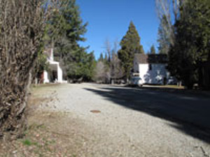
Downtown North Bloomfield

Once you get there, there are hiking trails, campgrounds and of course seeing the destruction that the miners seeking gold did to the surrounding mountains. It’s amazing that what was an ecological disaster at the time, has now become a state park. Time has pretty much healed the area with the forest coming back along with the animal life. In the center of the park is the historic town of North Bloomfield. The State has done a really good job of restoring many of the old buildings, and at certain times of the year they are open for you to go in and see what the old miners saw.

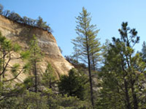
Mountain washed down by the miners seeking gold

In 1851 a miner came to town with a pocket full of gold. They followed him to what is now North Bloomfield and could find no gold, so they named the town Humbug. As the town grew to a population of 1,229 people, the residents wanted a post office, so they named the town Bloomfield. However there was another Bloomfield, so they named the town North Bloomfield. The present population is 2-12, I guess depending upon how many rangers are out there, and not counting the bears.

I could go on with the colorful history of the park, but detailed information is available at Wikipedia Malakoff State Historic Park and the website of the California State Parks Website

Take trip up there when the weather is nice, hike, relax, take a nice lunch with you and realize there is more to life then all the negative news we’ve been hearing lately.