Tag Archives: fishing

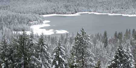
Lake Englebright in Nevada-Yuba County

lake-englebright2

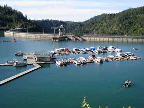
Englebright Lake offers a great deal of recreation including boating, camping and fishing. It’s located in Nevada-Yuba Counties, California. The lake was named after Harry Lane Englebright (January 2, 1884-May 13, 1943) who was a politician that served in the United States House of Representatives. He was a House minority whip between 1933 and 1943.  He was a mining engineer prior to entering politics in 1926 and was reelected every two years for the rest of his life.

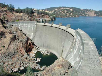
Englebright Dam is a concrete arch structure and was constructed for the storage of hydraulic gold mining debris. The dam spans 1,142 feet across and is 260 feet high. The dam is in the steep Yuba River gorge known as the Narrows, holding back a 9 mile long lake with a surface area of 815 acres. It has 24 miles of shoreline and is at an elevation of 527 feet.

The shoreline is rocky and steep, with some areas of sandy beaches with pines and oaks.
lake-englebright1

Operating Hours:

Office hours are Monday – Friday 8:00 a.m. – 4:00 p.m. The park is open all year.

Camping:

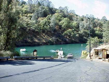
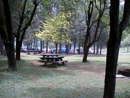
Camping at Englebright Lake is unique as all campsites are boat-in only and located along the lake’s 24 miles of shoreline. Each campsite consists of a table, fire grill, lantern hanger and level spot for tents. Portable restrooms are centrally located in all campgrounds. Drinking water is available near each launch ramp.

Group Camping: (reservations required)

Point Defiance Recreation Area features a group campground that is available by reservation only. To help protect our natural resources, groups are limited to 50 people. Call the park office for reservations.

Boating:

The lake provides plenty of space for the boating enthusiast, water skier or angler. Boats can be launched from one of two boat ramps located near the park’s entrance. Due to narrow canyons and sharp bends, the upper 4 miles of the lake are not suitable for waterskiing and/or towing any type of inflatable device. Therefore, these activities are restricted to the lower five miles of the lake. A counter-clockwise direction of travel is strictly enforced for the safety of park visitors. Types of boating allowed, power, row, Jet Ski, windsurf, canoe, sail, water ski, house, and inflatable’s are allowed. There is a full service marina with launch ramps. Rentals: fishing, canoe, water ski boats, houseboats & patio boats. There are also docks, berths, moorings and gas.

Fishing:

To the expert or beginning angler, Englebright means fish. Game fish such as rainbow and brown trout, large and smallmouth bass and Kokanee salmon abound in the lake’s clear, cool water. Catfish and sunfish can also be caught. Fish may be taken from the shore or boat by bottom fishing or trolling with bright, flashy lures.

Day Use:

Picnic facilities are available at the Narrows Recreation Area. Each site has a picnic table, barbeque grill and lawn area. Enjoy a short scenic hike to the dam overlook area or along the less strenuous fishing access trail.

Ranger Programs:Group tours and ranger programs can be scheduled by calling 530-432-6427.
Boat-in Camping: (first-come first-served basis)


Contacts:
U.S. Army Corps of Engineers
P.O. Box 6
Smartville, CA 95977-0006
(530) 432-6427 or fax (530) 432-6418
Email: englebright-info@usace.army.mil

Skippers Cove Marina  (530) 432-6302 offers boat  rentals, mooring, gas, sewage pumping and store facilities.

Additional information on the amount of settlement from the gold mining days and run off are available by a recent study made by the USGS at
Bathymetric and geophysical surveys of Englebright Lake
Rollins Lake in Nevada County

rollinslake1

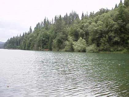
There are many recreational lakes in Nevada County, one of which is Rollins Lake. The lake is located in an unincorporated area called Chicago Park, so called because the first settlers there were first generation Italian-Americans who settled in the area from Chicago.

Rollins Lake is at an elevation of 2,100 feet, surrounded by a forest of pines, oaks and many other species of trees. It has a surface area of 900 acres with 26 miles of shoreline. You can sail or water ski on this lake which has many coves and long stretches of open water. Fishing is allowed, with many species of fish available which include brown trout, catfish, largemouth bass, crappie and bluegill. There is also swimming, picnicking, hiking and riding stables with horseback riding trails.

The boating which allowed on this lake include: power, row, Jet Ski, windsurf, canoe, sail, water ski and inflatable’s. You can also rent fishing boats with motors, canoes and paddle boats. There are four launch ramps, houseboat mooring and a floating gas dock.

rollinslake2

There are 250 developed camping sites for tents and RV’s. There are also full hookups for RV’s and trailer storage along with disposal station and flush toilets.

For further information contact:

Rollins Lake Resort Campground (530) 272-6100
Orchard Springs Campground      (530) 346-2212
Peninsula Campground                  (530) 477-9413
Long Ravine Campground             (530) 346-6166
View Larger Map

Bullards Bar Lake, Dobbins, California

Emerald Cove Marina - photo courtesy of Emerald Cove Marina

While Bullards Bar Lake is not in Nevada County, it is close enough to Nevada City and Grass Valley as to make it a designation for water skiing, house boating and fishing. It’s only 21 miles north of Nevada City off of Highway 49 in the historic gold country. The two closest cities are Nevada City, Grass Valley and Marysville.

The lake surface is at 2,000 foot elevation, 16 miles loan with about 60 miles of shoreline. The boating surface is 4,700 acres, which is a lot of area to boat in. There are only two launch ramps and once you are in the water, you are surrounded by a greenbelt covered with pine, oak, fir, madrone, dogwood and other species of trees native to the area. As you cruise up into the North Yuba Canyon, sheer cliffs of granite come down to greet the crystal clear water.

The North Yuba River is backed up by Bullards Bar Dam which is an awesome sight all by itself. Standing 645′ above the canyon floor, it holds back 960,000 acre feet of water. It’s the second tallest dam in California, 5th tallest in the United States. A hydro-electric dam, Bollards’ Bar Dam is operated and controlled by the Yuba County Water Agency. They are able to manage the water so that recreation access to the reservoir is never restricted.

Bullards Bar offers boat access campgrounds, land based sites, and shoreline camping permits. There are a total of only 160 sites, which limits the amount of people the area can accommodate. Emerald Cove takes site specific reservations for all camping.

For the fisherman, there are kokanee salmon, rainbow trout, german browns, largemouth, smallmouth and black bass, crappie, catfish, and bluegill. Bullards Bar has a reputation as having the best kokanee salmon fishing in California.

CAMPING
39 Boat access campgrounds – Call for reservations & fees
Pets, Full Hookups, RV & Trailer Storage, Disposal Station, Flush Toilets

BOATING
Power, Row, Jet ski, Windsurf, Canoe, Sail, Water-ski, and Inflatables are allowed.
There is a full service marina with gas and propane available
Rentals: Fishing Boats with Motors, House Boats

RECREATION
Fishing
Swimming, Picnicking, & Hiking
Snack Bar, Groceries, Bait & Tackle

For further information and reservations contact   Emerald Cove Resort and Marina (530) 692-3200


View Larger Map


Enhanced by Zemanta

Scotts Flat Lake, Nevada City, CA

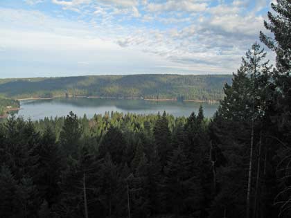
Scotts Flat Lake picture from my deck March 21, 2009

My house overlooks Scotts Flat Lake and as you can see in the picture above, I get a really beautiful view of the lake . It’s a wonderful experience living above such a body of water, which is constantly changing appearance, either due to wind or other forces of nature. At times I can look out and see fog completely covering the lake, at other times; wind plays with the water and makes designs that are captivating to the eye and imagination. The lake is large enough for fairly large sail boats (my daughter had a 25 foot long sail boat that she sailed on the lake and there are  larger sail boats that use the lake), along with ski boats, canoes and small boats for fishing.

Scotts Flat Lake is at 3,100 feet in elevation and has a surface area of 850 acres with 7.5 miles of shoreline lined with a forest of pine trees. There are two launch ramps, a marina, campsites, a picnic area, sandy beaches and a general store. (My house is at 3,700 foot elevation.)

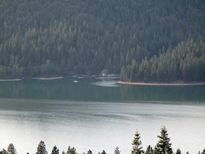
Looking at far side of Scotts Flat Lake, boat ramp and camp ground area. Notice the wind patterns

The fish in the lake are German Brown Trout, Massachusetts Brown Trout, Rainbow Trout, Kokanee, Large Mouth Bass, Small Mouth Bass, Bullhead Catfish and Channel Catfish. There are sites that are available for camping at Gate 1 with nightly single sites, and (1) one hundred person group site, Gate 2 has seventy five single sites and three group sites, one hosts twenty, one hosts thirty and  the third one hosts forty people.

Showers and flush toilets are available, along with multiple RV sites, but no RV hookupsare available. However, they do have dumping facilities for RV’s. You can bring pets, however they must be leashed at all times and they are not allowed along the beach or swim areas.

Below Scotts Flat Lake is Lower Scotts Flat, also called Deer Creek Reservoir which is much smaller than the upper lake. The only water craft I’ve seen here are mainly canoes and a few small boats for fishing.

For more information and to make reservations for camping follow this link Scotts Flat Lake Reservations

For a map of the lake follow this link Map of Scotts Flat Lake

Scotts Flat Lake Winter 2009

Scotts Flat Lake Feburary 2009

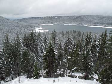
There was a nice blanket of snow which fell last night at my house. I would guess that there was a little over one foot of snow which made everything outside look like a winter wonder land. My house is located in Cascade Shores about 11 miles from Nevada City and at an elevation of 3,700 feet.

From my house you can overlook Scotts Flat Lake and notice that the water level is very low. It is normal for the lake not to be full this time of the year, but it is lower then normal. In January according to Susan Sindt, of the Nevada Irrigation District, the level of the lake was 31,000 acre feet. (An acre foot is one acre filled one with water one foot deep). We have gained some benefits from the recent rains, since the water level has gone from 31,000 acre feet in January to 32,200 acre feet as of today, according to Susan.

Scotts Flat Lake Febuary 2009

The last time the lake was lower was in the 1988-89 season at which time the water level was at 30,000 acre feet. Susan also said that NID’s overall water supply for the district is at 87 percent of normal for this time of the year. Hopefully we’ll get a lot rain this winter-spring season and the water supply will get back to normal.

By the way, if you are interested in camping, boating or fishing at Scotts Flat Lake go to the website of the Scotts Flat Lake Resort