Category Archives: Recreation

Bridgeport Historic Ranch and Famous Covered Bridge, Nevada County, CA

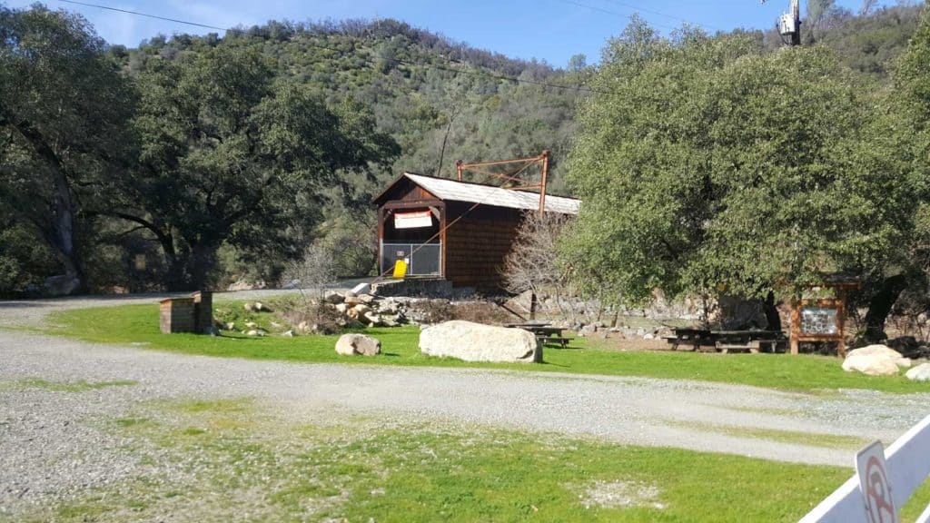
Bridge Port Bridge closed until repairs are completed. Photo by John J. ODell

By Judy Pinegar

Feb 26, 2017 –

          It was a beautiful sunny/cloudy day in Nevada County. Having a bit of cabin fever due to all the rain, John and I set out for Bridgeport with Hershey, our beautiful, black, half Labrador dog.

            Stopping first on the other side of the Yuba River, the sign said the walking trail(s) were closed, although we could see some people and sometimes dogs on the trail(s). But we had to pay the parking fee ($5.00), so we returned across the Yuba River to the main Park Site and Visitor Center. After paying (honor system) we proceeded to get a brochure and wander around the central area. The National and State registered Historic Landmark is the actual Bridgeport Covered Bridge, built in 1862 by David L Wood and the Virginia Turnpike Co. It was closed to walkers, or anyone, but restoration is expected. It is 229 feet long, making it the longest single span covered bridge in the entire United States!

            Then on to the “family beach” now mostly covered by water as the river is very high this year!  Several old pieces of mining equipment are around.  We then visited the old garden spot, the visitors center, the gas station ($0.12 per gallon!), and then the Barn which contained a large collection of various carriages, and farming vehicles. The Visitor Center was quite interesting, containing some preserved wildlife from the area that Hershey did NOT like at all! (Think panicked barking, a wild animal is on the loose!)  Also displayed were pictures of how high the river actually has risen in this area, way higher than this year for sure!!

            Then we took the easy Visitors Center Trail, past Kneebone Cemetery, Kentucky Creek (that trail was flooded), and back to the main area. There were a few confusing signs about “where” and “where not” you could take your dog, but overall it was a nice day. However it was really getting cold, so we left for home, hoping to come back with more time to walk (lots of trails) an a little better weather!!

            All and all, I recommend it as a really fantastic place to visit. See you on the trail! (Just look for Hershey)

For information South River State Park
Call (530) 432-2546

Bill Wells Tour of the Delta

httpv://youtu.be/P_GLn8SKwGA

Join some Delta rats for a short tour of the fabulous California Delta.  Bill Wells the Executive Director of the California Delta Chambers & Visitor’s Bureau gives a tour of Georgiana Slough and Walnut Grove, Mark Wilson a professional fishing consultant gives some tips for fishing in the Rio Vista area, and finally visit the Old Sugar Mill in Clarksburg  to learn the history of the area and see an interview with John Carvalho of Carvalho Family Winery.  You can’t learn much about the Delta in a half hour but this should give you an idea of the fun and excitement awaits you in the region.

Author:  Bill Wells
Executive Director of the California Delta
Chamber & Visitor’s Bureau

Help me keep this website going
Call today for buying or selling real estate

John J. O’Dell Realtor® GRI
O’Dell Realty
(530) 263-1091
Email John

BRE#00669941

Incredible Speed Flying Mont Blanc

httpv://vimeo.com/36398302

The above video was shot twice, the morning video had to be scrubbed because one of the speedriders crashed into the mountain in the morning.

Speedriding or SpeedFlying, what ever you want to call it, looks impressive and thrilling to say the least!

Speed flying is a unique hybrid sport that has combined elements of paragliding, parachuting, and even skiing to create a new sport. Like paragliding, Speed flying is done by launching from a slope with the wing overhead, already inflated by the incoming air. The main difference between speed flying and paragliding, is that speed flying is meant to create a fast, thrilling ride close to the slope, while the point of paragliding is usually to maintain a longer, gentler flight. The fast landing technique for Speed wings is similar to that used in parachuting. However, parachuting or skydiving is done from a plane or fixed object (BASE jumping), and the wing is designed to arrest the free fall. Newer designs of hybrid-wings (also called mini-wings) are now being produced to allow a high speed “hike and fly” from mountainous areas. They can be soared in strong laminar winds and thermalled similar to paragliders, and may also be trimmed for a more traditional Speed flying descent.

Because of the fast flight speed (30–145 km/h or 20-90 mph), and close proximity to the slope and obstacles, injury and death are considerable risks in this sport. Over 25 pilots have already suffered fatal injuries worldwide since 2006. Also, because of its small size and high wing loading, the wing responds quickly to little pilot input which makes professional instruction very important. However, the high velocities help the glider remain pressurized and resistant to collapse even in turbulent conditions. Proper equipment such as helmets, padded harnesses, and reserve parachutes can help reduce injuries. Advanced wing and ski training, and thorough knowledge of site conditions and hazards are imperative to practicing this sport safely.

Even if provoked, a collapse would open fast without much disturbance. So if you start and land on skis, stay away from the terrain during the flight and work a bit on your landing technique, then you could try one of  these mini-wings with a relatively low risk (but still with great fun!)
The problems only begin when you go from Speedflying (staying above the ground) to Speedriding (Touch and Go’s with your skis) as very good judgment is needed how your glide path will come out, wether you will make it over that rock or tree or wether you might hit the ground in a curve etc.  Great caution and discipline is necessary: you should learn to know your wing step-by-step, before you start to touch the ground more often.

Anyhow, good luck, I don’t think I want to start speedriding, what do you think?
Please help out to keep this blog going
Let me sell or help you buy your new home or land

John J. O’Dell Realtor® GRI
O’Dell Realty
(530) 263-1091
Email John

DRE#00669941

Enhanced by Zemanta

Scotts Flat Lake January 2013

Image 1 of 5

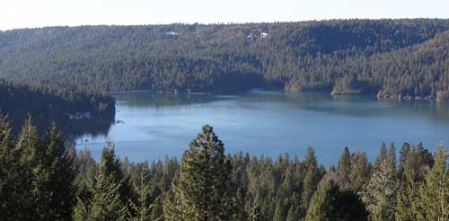
Scotts Flat Reservoir seems to be very close to the spillway elevation which is approximately 3074.8 feet in elevation. That’s the elevation in which the water starts flowing out due to increase in volume from rainfall or from release of water from upper dams.  As of today, the elevation of the water is 3073 or about 1.8 feet from flowing over the spillway.

In the pictures above, you can see how close to the top of the dam the water is. Camping, fishing, swimming, sunning, boating, water skiing, sailing, board sailing and other activities are popular at  Scotts Flat reservoirs in the Sierra foothills. Day use parks, campgrounds and beaches which is operated by a private operator under contract with Nevada Irrigation District.

Scotts Flat is situated among the tall pines at the 3100-foot elevation nine miles east of Nevada City via Highway 20 and Scotts Flat Road. It offers 169 campsites at two large campgrounds, plus a group camp. Across the lake, accessible via Red Dog and Quaker Hill Roads from Nevada City, is the Cascade Shores Day Use Area.


For all your real estate needs
Email or call today:

John J. O’Dell Realtor® GRI
Civil Engineer
General Contractor
(530) 263-1091
Email jodell@nevadacounty.com

DRE#00669941

View Larger Map

Enhanced by Zemanta

Hiking The Yuba River Independence Trail Going East

By Judy J. Pinegar

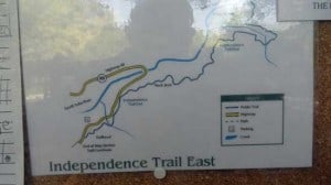
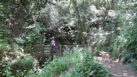
On Sunday, May  27, 2012 John and I went for a walk. Leaving the Flour Garden Cafe in Grass Valley, we traveled north on Hwy 49 to the parking lot for the Independence Trail. Studying the map, we decided to try the East Trail. We had Angel on a leash, and it seemed to be the direction she wanted to go, so we humored her.

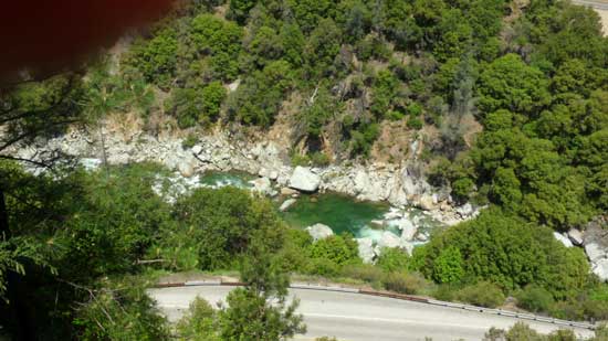
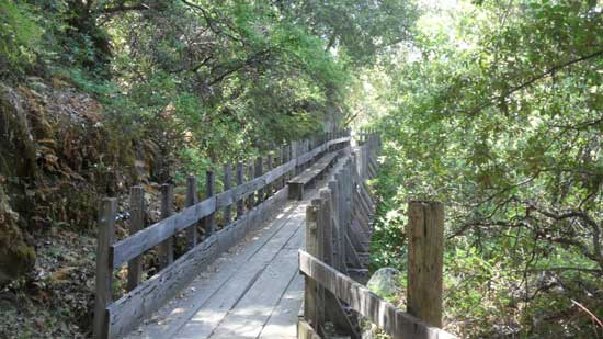
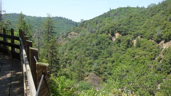
The first part of the trail seemed to literally be at two levels, the main trail on a lower level, a smaller trail on the rise to the left of the main  trail. Occasionally those traveling the higher trail were forced to move down to the lower trail, where the trail narrowed or over bridges, but the upper trail continued for quite some way. For a while the trail seemed to follow the highway, but finally we turned to follow the river, and there was a beautiful green swimming hole.


Creek Crossing
Creek Crossing

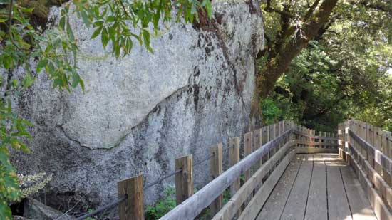
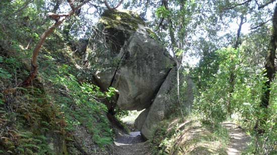
Continuing, the trail turned into a bridge the skirted the side of huge rocks, no ground beneath our feet! And then a neat tunnel, a rock perched on top of twp or three other rocks, and you could pass underneath if with just a little bit of tucking out heads; there was no way around it, so if you wanted to continue the walk, you went under the rock!!

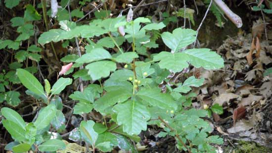
Oh and did I mention the poison oak??  You could tell they had TRIED to eradicate the stuff on the main trails, but it was still there, hiding a little way back from the trail.  As a person who is horribly allergic, I stayed in the middle of the trail and hoped John would keep Angel out of it (she was getting no pats from me until she had a bath!).

Posion Oak
Poison Oak

And speaking of Angel we had been forcing her to keep going on for about the last 15 minutes, for a strong, fierce looking dog, she really is a sissy in the wilds! After a good 45 minutes or so we met a couple coming back. They said they had walked for about an hour and hadn’t seen the river yet. We decided to follow Angels lead and come on back, next time maybe we will leave her home!

Judy J. Pinegar is a writer and her articles have appeared in many publications
John J. O’Dell Realtor® GRI
Civil Engineer
General Contractor
(530) 263-1091
Email jodell@nevadacounty.com

Enhanced by Zemanta

Bullards Bar Reservoir & Emerald Cove Marina, Dobbins, California

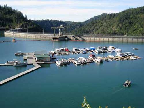
Emerald Cove Marina - photo courtesy of Emerald Cove Marina
Emerald Cove Marina – photo courtesy of Emerald Cove Marina

Bullards Bar Reservoir is not in Nevada County, but it is close enough to Nevada City and Grass Valley as to make it a destination for water skiing, house boating and fishing. It’s only 21 miles north of Nevada City off of Highway 49 in the historic gold country. The three closest cities are Nevada City, Grass Valley and Marysville.

The lake surface is at 2,000 foot elevation, 16 miles long with about 60 miles of shoreline. The boating surface is 4,700 acres, which is a lot of area to boat in. There are only two launch ramps and once you are in the water, you are surrounded by a greenbelt covered with pine, oak, fir, madrone, dogwood and other species of trees native to the area. As you cruise up into the North Yuba Canyon, sheer cliffs of granite come down to greet the crystal clear water.

The North Yuba River is backed up by New Bullards Bar Dam which is an awesome sight all by itself. Standing 645? above the canyon floor, it holds back 960,000 acre feet of water. It’s the second tallest dam in California, 5th tallest in the United States. A hydro-electric dam, Bullards Bar Dam is operated and controlled by the Yuba County Water Agency. They are able to manage the water so that recreation access to the reservoir is never restricted.

Bullards Bar offers boat access campgrounds, land based sites, and shoreline camping permits. There are a total of only 160 sites, which limits the amount of people the area can accommodate. Emerald Cove Marina takes site specific reservations for all camping.

For the fisherman, there are kokanee salmon, rainbow trout, German browns, large mouth, small mouth and black bass, crappie, catfish, and bluegill. Bullards Bar has a reputation as having the best kokanee salmon and black bass fishing in California.

CAMPING
Campgrounds – Call for reservations & fees
Pets, NO Hookups, Boat & Trailer Storage, Some Flush Toilets

BOATING
Power, Row, Jet ski, Windsurf, Canoe, Sail, Water-ski, and Inflatables are allowed.
There is a full service marina with gas and propane exchange available
Rentals: Houseboats, Ski Boats, Jet Skis, and Pontoon Patio Boats

RECREATION
Fishing
Swimming, Picnicking, & Hiking
Snacks, Groceries, Bait & Tackle and Fuel Dock

For further information and reservations contact   Emerald Cove Marina (530) 692-3200

View Larger Map
For all your real estate needs, call or email:

John J. O’Dell Realtor® GRI
Real Estate Broker
O’Dell Realty
(530) 263-1091
jodell@nevadacounty.com

Exercise: Good, Leg Pain, Bad – Here’s How to Get One and Avoid the Other

by Lisa J. Lehr

Exercise is good. Some of us have undoubtedly made a New Year’s resolution to exercise more. And walking is, for most people, the best choice because it:

1. Doesn’t require much training;

2. Doesn’t require special equipment;

3. Doesn’t (usually) require travel to a special place, such as a gym, pool, or recreational area.

Now, number 3 is somewhat qualified because, while most people in Nevada County live on or near a road with reasonably little traffic, walking on a paved road poses its own set of problems. If you get your regular exercise by walking along a public roadway, you may have noticed persistent or intermittent pain in the joints or muscles of your right leg.

In most places, public roads are constructed with “crowning”; that is, the road is higher at the center and slopes down to the sides. This is to help rain and melting snow run off more quickly instead of pooling in the middle, creating a driving hazard and damage to the road.

We learned as children to walk facing traffic, for obvious safety reasons: if an approaching car is too close to you, you can see it in time only if it’s approaching from the front—unless you have eyes in the back of your head (or wear a little tiny rear-view mirror, as cyclists sometimes do). The problem for walkers is that, as you walk along the edge of the road, one foot is always landing on a higher surface than the other. And over time, this can lead to pain in the hip, knee, and/or other parts of your leg. That, in turn, may discourage you from exercising; or you may just “live with” the pain, having no idea that it’s fixable. I actually lived with this problem, off and on, for a couple decades before it dawned on me what might be causing it!

Here are some suggestions to avoid one-sided leg pain:

1. Traditional wisdom suggests that pedestrians “should” walk on the side facing traffic. Laws may vary from one locality to another, although I’ve never heard of anyone being ticketed for walking on the “wrong” side of the road—and I certainly see lots of people doing it. Safety is our primary concern; however, I spoke to a physical therapist about this matter, and he recommends alternating sides every quarter mile.

2. If you walk on a rural road and/or exercise very early in the morning or late in the evening, you may be able to get away with walking in the middle of the road. Be aware of your surroundings, turn off your iPod so you can hear any approaching vehicles, and get out of the way if one comes.

3. Look ahead as you walk and try to spot places where the shoulder flattens or slopes back up; adjust your path to give your right leg a rest. Much of Nevada County’s roadways have irregular curbing (meaning none, or covered with dirt, etc.), and there are often places where you can walk off the pavement.

4. Whenever possible, walk at a park or other place that has designated walking paths. Yes, this may require a trip in a car, but it may be the solution for you.

5. Do not walk on the sidewalk. Sidewalks may be flat, but concrete is an even harder surface than blacktop, and the resulting foot and leg pain may be even worse.

6. Make sure you’re wearing good shoes—shoes that are designed specifically for walking and not for some other sport. Wear good socks too (not too thin). Interestingly, I just read an article in the Sunday Bee about running barefoot. The practice seems to have a lot of followers! Speaking for myself, the fear of foot injury is too great, but feel free to investigate this.

Whatever you decide to do, don’t use one-sided leg pain as an excuse to stop exercising. Simply try the above suggestions to work with the problem. See a physical therapist if necessary. As a last resort, choose another type of exercise, at least until the leg pain eases.

Lisa J. Lehr is a writer, copywriter, and fitness enthusiast living in Grass Valley. She can help you promote your business with a full range of online and offline marketing pieces. A member of Empire Toastmasters, she’s available to speak to your business or professional group. Visit her website www.justrightcopy.com for more information, opt in for a message series, and receive a free Marketing Guide.


Lisa J. Lehr
I write words that make you money–just ask me how.
Vist Just Right Copy
Visit my website and sign up for my free marketing tips.
New! No cost Marketing Guide now available at my website.
Can’t Afford a Big Home, How About a Tiny House?

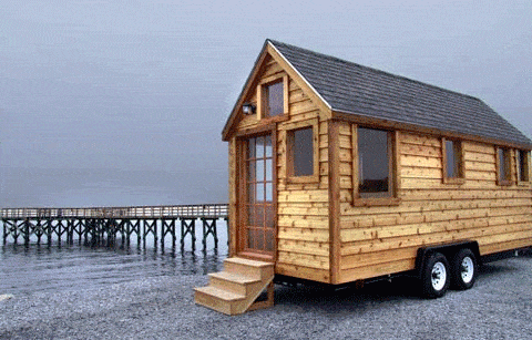
As Americans downsize in the aftermath of a colossal real estate bust, at least one tiny corner of the housing market appears to be thriving. To save money or simplify their lives, a small but growing number of Americans are buying or building homes that could fit inside many people’s living rooms, according to entrepreneurs in the small house industry.

Some put these wheeled homes in their backyards to use as offices, studios or extra bedrooms. Others use them as mobile vacation homes they can park in the woods. But the most intrepid of the tiny house owners live in them full-time, paring down their possessions and often living off the grid.

“It’s very un-American in the sense that living small means consuming less,” said Jay Shafer, 46, co-founder of the Small House Society, sitting on the porch of his wooden cabin in California wine country. “Living in a small like this really entails knowing what you need to be happy and getting rid of everything else.”

Read more: at the Sacramento Bee

For all your real estate and construction needs
John J. O’Dell
Real Estate Broker
General Contractor
DRE# 00669941