Category Archives: History of Nevada County

Bridgeport Historic Ranch and Famous Covered Bridge, Nevada County, CA

Bridge Port Bridge closed until repairs are completed. Photo by John J. ODell

By Judy Pinegar

Feb 26, 2017 –

          It was a beautiful sunny/cloudy day in Nevada County. Having a bit of cabin fever due to all the rain, John and I set out for Bridgeport with Hershey, our beautiful, black, half Labrador dog.

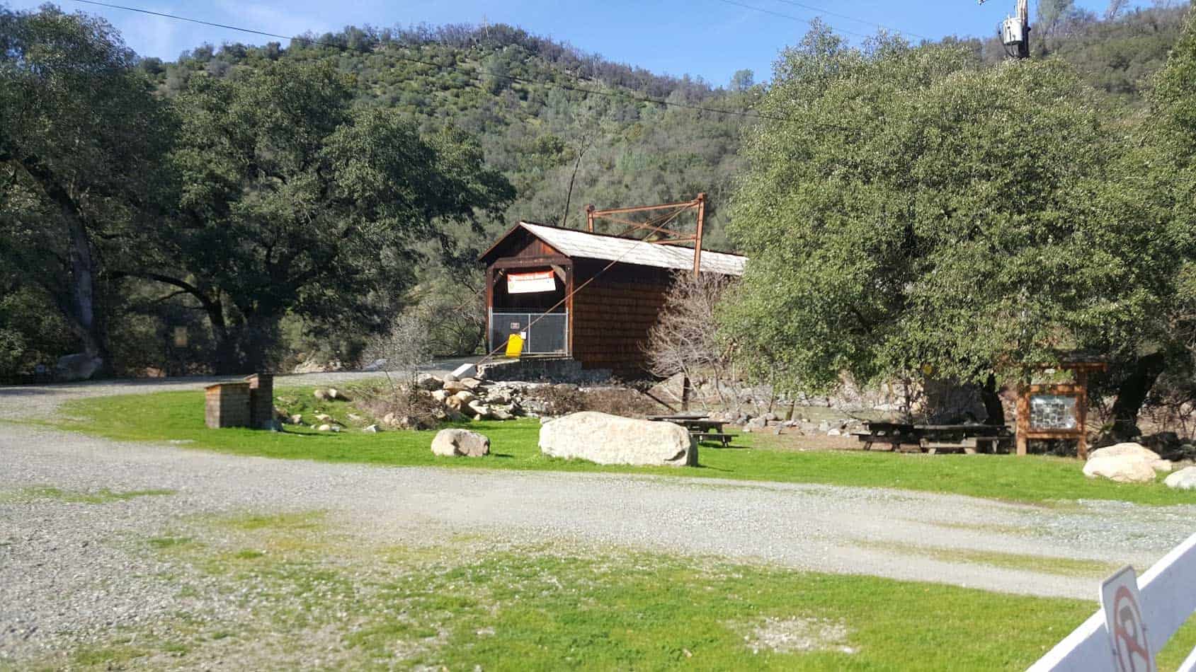
            Stopping first on the other side of the Yuba River, the sign said the walking trail(s) were closed, although we could see some people and sometimes dogs on the trail(s). But we had to pay the parking fee ($5.00), so we returned across the Yuba River to the main Park Site and Visitor Center. After paying (honor system) we proceeded to get a brochure and wander around the central area. The National and State registered Historic Landmark is the actual Bridgeport Covered Bridge, built in 1862 by David L Wood and the Virginia Turnpike Co. It was closed to walkers, or anyone, but restoration is expected. It is 229 feet long, making it the longest single span covered bridge in the entire United States!

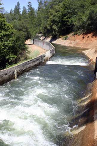
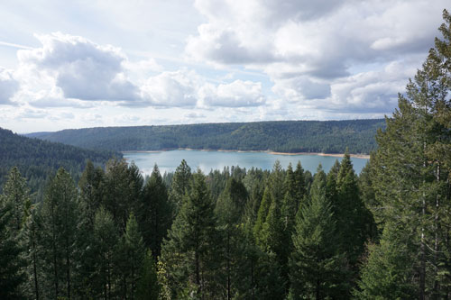
            Then on to the “family beach” now mostly covered by water as the river is very high this year!  Several old pieces of mining equipment are around.  We then visited the old garden spot, the visitors center, the gas station ($0.12 per gallon!), and then the Barn which contained a large collection of various carriages, and farming vehicles. The Visitor Center was quite interesting, containing some preserved wildlife from the area that Hershey did NOT like at all! (Think panicked barking, a wild animal is on the loose!)  Also displayed were pictures of how high the river actually has risen in this area, way higher than this year for sure!!

            Then we took the easy Visitors Center Trail, past Kneebone Cemetery, Kentucky Creek (that trail was flooded), and back to the main area. There were a few confusing signs about “where” and “where not” you could take your dog, but overall it was a nice day. However it was really getting cold, so we left for home, hoping to come back with more time to walk (lots of trails) an a little better weather!!

            All and all, I recommend it as a really fantastic place to visit. See you on the trail! (Just look for Hershey)

For information South River State Park
Call (530) 432-2546

The Mad Russian of Texas Creek

Source Nevada Irrigation District

One of the most colorful characters in Nevada Irrigation District’s history is the legendary “Mad Russian” of Texas Creek.  The solitary but likeable emigrant loved his vodka and garlic, talked to the animals and even kept a pet skunk during 13 years as a ditch tender at the isolated mountain station.

Born in Russia, Walter Proscurin found his way to the Gold Country and held a few odd jobs before he hired on with NID in the early 1950s. He worked summers in the mountains repairing canals and flumes.

Walter’s unusual life in the high country was traced through interviews with NID retirees Jason Davis, Frank “Snowshoe Fritz” Plautz, Lee Droivold and Kent Pascoe.

A year around employee was needed at Texas Creek, four miles southwest of Bowman Reservoir, and it was at the onset of the record setting winter of 1952 when Walter began his career as a high country ditch tender.

“I remembered him calling for help because there was so much snow pushing against his house. He thought the snow would push it into the creek,” said Davis.  Davis used to pack supplies into NID’s remote mountain stations.

Asked what he remembered most about the Russian, DAvis lauged, ” He used to take garlic with his vodka.  You couldn’t get within six miles of him”


“He ate garlic like we eat bread,” added Plautz, who retired after 22 years as NID’s Bowman lake tender. “He was serious.  He wasn’t much for joking. But he was a good-hearted guy. He always wanted to do something for your”

Frank’s wife Ramona, said Walter was very eccentric and may have gained his nickname of the Mad Russian because of the way he would wave a rifle and chase hunters out of the Texas Creek area.

Walter lived alone in a stone and wood cabin on the bank of the Bowman-Spaulding Canal near its crossing at Texas Creek. A foundation is all that remains of the cabin today.

The stout naturalized U.S. citizen, stood about 5′ 10″ and weighed 220 ponds, was responsible for keeping the water flowing through several miles of canals and old wooden flumes from Windy Point to the Clear Creek Tunnel.

Pascoe said the Russian was a big hit during his ventures into Nevad City. “He used to throw himself birthday parties at a Nevada City bar. One year, he must have spent $500 to $700 buying everyone drinks.

He loved animals and he would feed the coyotes. He had a bear coming up there for a few years. He always kept a salt lick for the deer.. He fed the birds and kept a pet skunk und the house.

The 63 year old Russian died on March 24, 1968. The cause of death was listed as heart problems and pneumonia and died alone. He is buried in the Pine Grove Cemetery in Nevada City.

Source: NID Waterways, Summer 2016

Help keep this blog going
Call John O’Dell
O’Dell Realty
BRE 00669941

Error: Contact form not found.


Nevada Irrigation Districts Lakes and Canals have Unusal Titles

Scotts  Flat Reservoir. Picture taken from my deck. John J. O'Dell
Scotts Flat Reservoir. Picture taken from my deck. John J. O’Dell

How’s the water out there in Wiskey Diggins Canal? Was the Fiddler Green Canal titled after an early day musician? Did you ever wonder how the DSL Canal was named?

The names of water storage and distribution facilities throughout NID are colorful and unusual but, unfortunately, the origination of many of them has been lost through the years.

Many facilities are named for builders, such as Faucherie Reservoir, or for the geographic areas they serve, such as Bald Hill or Pet Hill canals.

Of course, many lakes and canals carry names that are rooted in the area’s rich mining history.

The DS Canal is the lowest elevation of the two NID canals crossed by Red Dog and Banner Lava Cap roads near Nevada City. It was built by NID in 1927-28 to carry water from Lower Scotts Flat into the Nevada City-Grass Valley area.  The DS Canal follows the south side of Deer Creek, hence DS for Deer Creek South. If NID had followed through with an initial plan for a canal on the north side, we would today have the DN Canal.

How Scott Flat was named is unclear, but it is widely understood that it was due to the Scottish miners who lived and worked there in the 1850’s and 1860’s.  Schools once stood near what is now the campground on the north side of the lake.

Rollins Reservoir was named for J.L. Rollins, manager of the Bear River Water and Power Co., the company from which NID acquired the land to build the reservoir.

NID’s first modern water treatment plan, the Elizabeth L. George plant on Banner Mountain, opened in 1969 and was named after the long time community leader who helped gain funding for its construction.

In the high country, Faucherie Reservoir, built prior to 1880, was named after a French engineer who worked for the Eureka Lake & Yuba Canal Co.  “The French must have had a strong influence because French Lake, located upstream of Faucherie and constructed in 1857-59 was originally called Eureka Lake and later changed to French Lake,” wrote NID retiree Terry Mayfield who documented much of the district’ history during his 34 years with the district.

One of NID’s most historic canals is reputed to be the first mining canal in the state.  The Rough & Ready Canal was begun in 1850 as the first effort to build a large-scale mining ditch in California.

According to the Thompson & West History of Nevada County, “a man named Moore commenced to dig one from Deer Creek above Nevada City to Rough and Ready. The magnitude of the undertaking astounded the miners and they thought Moore was a lunatic, but he persevered until he had completed one mile, and then abandoned the enterprise.”

Moore’s project was taken over by a company in 1851 and by 1854 the canal to Rough & Ready was complete. NID took over the canal in 1925 as part of a water system acquired from the old Excelsior Water & Power Co.  Portions of the 13-mile-long Rough and Ready & Ready Canal remain in use today.

Source: Nevada Irrigation District newsletter Volume 35 Number 4 Winter 2014/2015

Help keep this blog going
Call or write today for all your
real estate needs

John J. O’Dell Realtor® GRI
O’Dell Realty
(530) 263-1091

Error: Contact form not found.


BRE#00669941

Seeking Community Showcase Acts for the Nevada County Fair

http://www.dailykos.com/
Photo credit: http://www.dailykos.com/

Applications available for those interested in performing or demonstrating at this year’s Fair 

The Nevada County Fair is now accepting applications for local entertainers and community acts to perform at the 2014 Nevada County Fair, August 6 – 10.  Do you have a dance group you’d like to see perform at the Fair? Does your group have a skill they’d like to demonstrate to Fair-goers? Want to do a martial arts demonstration or a cheerleading demonstration or show off your baton twirling skills? If so, the Fairgrounds wants your application. This is a great way to share your talents with the community!

Applications are now available on the website at www.NevadaCountyFair.com.  To be considered, the application must be returned to the Fairgrounds by June 2. There is no paid compensation for community showcases and demonstrations.

The application is for those interested in performing on the Dance Pad (available afternoon and evening hours); The Green (available during afternoon hours); or the Tumbleweed Stage (available evening hours only).

This year’s Fair is August 6 – 10, and the theme is “Simply Fun.” For more information, visit www.NevadaCountyFair.com or call (530) 273-6217.

Help to keep this blog going
Buying or selling real estate call:

John J. O’Dell Realtor® GRI

Real Estate Broker
Civil Engineer
General Contractor

O’Dell Realty

(530) 263-1091
Email johnodell969@gmail.com

BRE# 00669941

Enhanced by Zemanta

The History of Nevada County

By Judy J. Pinegar

The earliest settlement in Nevada County was made in the summer of 1848 at a place called Rose’s Corral which was located between the Anthony House and Bridgeport. Early in the spring of 1849 a group of mountaineers from Oregon known as the Greenwood Company mined for gold at Illinois Bar on the South Yuba River. They were followed by emigrants from Indiana. In the fall of 1849, the Greenwood Company made winter camp at Jefferson, and the Indiana group moved further upstream to Washington. In that same autumn that Captain John Pennington’s party struck rich diggings on Deer Creek and built the first cabin on Gold Run, the site that was to become Nevada City.

Originally a mining camp founded along Deer Creek in 1849, Nevada City rapidly became the largest and wealthiest mining town in California. At one point, Nevada City was the third largest city in California with a population of 10,000. Nevada City’s good fortune allowed miners and settlers to enjoy plush gambling establishments, hotels, saloons, and stores. However, like many big cities that sprang up quickly during the rush for instant wealth, early Nevada City shared a darker side of claim jumping, murder, brothels and opium dens.

By the 1850’s Nevada City’s wealth began to wane, and as miners moved on in search of new claims and stories of gold and riches, a quiet and quaint city emerged. Two fires in 1856 and 1863 raced through Nevada City almost completely wiping out the town. The beautiful architecture that stands today is testament to the will of the people of Nevada City who rebuilt the town completely not once, but twice.

Hydraulic mining, Nevada County, CA, 1866
Hydraulic mining, Nevada County, CA, 1866 Photo courtesy of http://www.lawyersgunsmoneyblog.com

Nevada County was created in 1851 from parts of Yuba County because of the increase in population in the area and the distance to travel to courts which made it necessary to create a new county. The county was named after the mining town of Nevada City, a name derived from the term “Sierra Nevada.” The word nevada in Spanish means “snowy” or “snow-covered.” Nevada City has carried many monikers through its history; Caldwell’s Upper Store, Coyoteville, and Deer Creek Dry Diggings, but Nevada was chosen in the 1850s to give the town a cultured name.

English: Nevada City, CA, USA
Nevada City, CA, USA (Photo credit: Wikipedia)


In 1851 the newly formed Nevada County copied the name. The State of Nevada used the name 10 years later in 1861. The region came to life in the gold rush of 1849. Many historical sites remain to mark the birth of this important region in California’s formative years. Among them are the Nevada Theater in Nevada City, which operates to this day and once hosted Mark Twain among other historical figures. The gold industry in Nevada County thrived into the post WWII days.

The county had many firsts and historic technological moments. The first long-distance telephone in the world, built in 1877 by the Ridge Telephone Company, connected French Corral with French Lake, 58 miles (93 km) away. It was operated by the Milton Mining Company from a building on this site that had been erected about 1853. The Pelton wheel, designed to power gold mines, still drives hydro-electric generators today. Nevada City and Grass Valley were among the first California towns with electric lights.

World’s First Long-Distance Telephone Line in French Corral, California
Commemorating World’s First Long-Distance Telephone Line.   Monument located in French Corral, California. Picture courtesy of http://www.noehill.com


The Olympics, NASA, and virtually every television station around the country utilizes video/broadcasting equipment designed and manufactured by Grass Valley Group, founded in Grass Valley. Electronic medical dosing equipment was first developed and manufactured in Nevada County. The first commercially viable picture-phone was developed in Nevada City. More than fifty high tech and applied tech companies, and more than one thousand hardware and software design and development professionals.

Judy J. Pinegar is a writer and her articles have appeared in many publications.


For all your real estate needs
Email or call today:

John J. O’Dell Realtor® GRI
Civil Engineer
General Contractor
(530) 263-1091
Email jodell@nevadacounty.com

DRE#00669941

Enhanced by Zemanta

The Town of Washington (originally called Indiana Camp) Nevada County, CA

Photo courtesy of Washington Hotel   www.washingtonhotel.net
Photo courtesy of Washington Hotel www.washingtonhotel.net

By Judy J. Pinegar

This little town in Nevada County is located on the banks of the South Fork of the Yuba River. It is located off Highway 20 between Nevada City and Interstate 80. Washington boasts a population on about 200, but that fluctuates seasonally and the town has a lot of tourist traffic in the summer.

Washington was founded in 1849, as were most of the cities in Nevada County; it was all about the Gold Rush!! These particular miners were from Indiana, so the settlement was first named Indiana Camp, but renamed to Washington in 1850. The area produced a large amount of placer gold, after that hard rock and hydraulic mines were established and were also very productive. Many people of Chinese descent worked in the area at these times.

The hotel in the town of Washington started with Hessel B. Buisman who was born in Holland in 1827, he landed in San Francisco in 1850. He originally kept a hotel in the town of Jefferson located near Washington from 1852 to 1857. He then came to Washington building a two story hotel which could accommodate up to 30 guests.

After the Buisman owners passed away, their daughter and her husband Eldridge Worthley kept the hotel for years. The hotel was called “The Worthley” or “Washington Hotel” and sat on the same site as the current hotel today. The hotel stable was across the street.

At 11 PM, August 16th, 1867 The Big Fire broke out in a nearby cabin. It jumped from house to house and destroyed almost every business downtown Washington including the Hotel. The hotel was rebuilt.

On April 21st, 1896 another fire started in the kitchen of the Washington Hotel. This fire destroyed the hotel and several buildings nearby. This time, Worthley had taken out fire insurance previous to the fire. The hotel was rebuilt as fast as the weather would allow. The picture shows the new and improved Washington Hotel after being rebuilt in 1896.

Photo courtesy of Washington Hotel www.washingtonhotel.net

The Washington Mining District was always served by operators of small stage lines. This photo shows the company stage of Prescott and Grissel. A daily trip used to leave The National Hotel in Nevada City at 7 AM and arrive in Washington around noon. This was used to rest between trips or take shelter from the weather. Now the drive only takes 25 minutes in your car.

Picture from the Red Ledge Mine in Washington. The gold/quartz veins occur in the sedimentary rocks close to the contact with serpentine. Mariposite is often in association with the serpentine, and in close proximity to the gold. Photo courtesy of http://www.mindat.org/loc-3515.html

The town of Washington currently consists of the Washington Hotel/bar, a restaurant, a grocery store, a one room schoolhouse that has educated students continuously for over 100 years, and two trailer park campgrounds

There are two trailer parks, Gene’s Pine Aire Campground and the River Rest Resort have been in business since the 1960’s with various owners. Campsites are often to capacity, so reservations are advised.

Picture courtesy of River Rest Resort (see above)


View Larger Map

For all your real estate needs
Email or call today:

John J. O’Dell Realtor® GRI
Civil Engineer
General Contractor
(530) 263-1091
Email jodell@nevadacounty.com

DRE#00669941

Enhanced by Zemanta

Penn Valley, California

By Judy J. Pinegar

The first residents of the area were the Maidu Indians, who migrated in about 1833 from the Sacramento Valley. The four main areas they lived were the sites now called Bridgeport, Lake Wildwood, Indian Springs and Money Flat. However everything changed with the discovery of gold and the white settlers moved into the area, when Penn Valley became one of the first settlements in the county.


Photo courtesy of the Penn Valley Chamber of Commerce

The name Penn Valley may come from a Madam Penn who is remembered for her determination to make money if hard word would do it. Coming to the area in 1849, she took her turn with her husband carrying dirt to wash and rocking out the gold.  Later she had a 320 acre homestead at the intersection of Squirrel and Grub Creeks, which grew to 700 acres (most of Penn Valley) after being purchased in October 1852.

Early settlement of the area was probably started due to its location on a freight wagon route from Sacramento to mining regions east. Later men gave up their picks for plows and the valley produced fresh meat, fruits and vegetables to miners as far away as Nevada (state). In the late 1800’s the valley was home to a thriving dairy industry. In Western Gateway park is the rebuilt Butter Maker’s Cottage to commemorate the importance of the dairy industry in the area.


Photo Courtesy of Penn valley Chamber of Commerce

Today the valley is still a peaceful place, but continues to gain business opportunities and residential growth. Horses, llamas, deer and wild turkeys all coexist in the area with about 12,000 residents. The Western Gateway Park, Historic Bridgeport and Lake Englebright are all a short drive away.

Photo Courtesy of Penn valley Chamber of Commerce

Lake Wildwood is gated community in the area, off  Highway 20 on Pleasant Valley Road, which now has about 5,000 full time residents. Over half of the residents are retirees, but more and more families are moving in and the average age continues to go down.

Judy J. Pinegar is a writer
Her articles have appeared in many publications


For all your real estate needs
Email or call today:

John J. O’Dell Realtor® GRI
Civil Engineer
General Contractor
(530) 263-1091
Email jodell@nevadacounty.com

DRE#00669941

Enhanced by Zemanta

Rough & Ready, California

Picture courtesy of the Rough and Ready Chamber of Commerce

By Judy J. Pinegar

The first established settlement in Rough and Ready was made in the fall of 1849 by a mining company from Wisconsin known as the Rough and Ready Company. Their leader, Captain A. A. Townsend, named the company after General Zachary Taylor (nicknamed “Old Rough and Ready”) who had recently been elected the 12th President of the United States. Captain Townsend had served under “Old Rough and Ready” during the U.S.-Mexican War.

Gold was easy pickings, and by the late 1840s, the population of the town of Rough and Ready had exploded to over 3,000. The town had plenty of uncontrolled lawlessness and a growing resentment of the government which had imposed a Mining Tax on all claims. On April 7th, 1850, a mass meeting was called to propose seceding from the Union.

The Great Republic of Rough and Ready was formed that day as a free and independent republic. The townspeople elected Col. E.F. Brundage as President, and  Justice of the Peace Hans Q. Roberts as Secretary of State, who then signed a constitution similar to that of the United States.

The Republic of Rough and Ready lasted only three months as the world’s smallest nation. It came to a halt when preparing for a fourth of July celebration, it was realized as an independent country it had no reason to celebrate.  A popular vote restored the new Republic to the United States followed by the most riotous Fourth celebration ever held anywhere. An alternate story for the reason Rough and Ready rejoined the union is that Nevada City refused to sell the “foreign” miners liquor!

In 1859, a devastating fire destroyed most of Rough and Ready as shown in the photo.

Picture courtesy of the Rough and Ready Chamber of Commerce

Picture courtesy of the Rough and Ready Chamber of Commerce

Rough and Ready is located west of Grass Valley, California, on State Route 20 at the junction of State Route 49, approximately 62 miles (100 km) from Sacramento. The post office at Rough and Ready was established in February 1851. Among the oldest buildings are the blacksmith shop (1850s), the Grange (1850’s), the Odd Fellows Hall (1854), and the Old Toll House. The population was 963 at the 2010 census.


Picture courtesy of the Rough and Ready Chamber of Commerce


The Rough and Ready Calendar of Events includes the following. It is a great place to visit on a weekend…come for a drive!

Weekly

Every Sunday

The Fruit Jar Pickers

10am to Noon at the Grange in downtown Rough and Ready


Monthly

Every 2nd Saturday

Breakfast at the Grange

8am to 10 am at the Grange Hall. Great food and entertainment for $5.00

Annually

Last Sunday in June

Secession Days in downtown Rough and Ready. 7am to 3pm.

 Annually

Last Sunday in September

Chili Cook-off in downtown Rough and Ready. 10am to 3pm.

Additional information about Rough and Ready and these events may be obtained from the Rough and Ready Chamber of Commerce webpage

Judy J. Pinegar is a writer and her articles have appeared in many publications


For all your real estate needs
Email or call today:

John J. O’Dell Realtor® GRI
Civil Engineer
General Contractor
(530) 263-1091
Email jodell@nevadacounty.com

DRE#00669941

Enhanced by Zemanta

Empire Mine State Park, Grass Valley

httpv://www.youtube.com/watch?v=J_TjI2qLwBI

The Empire Mine is the site of the oldest, largest, and richest gold mine in California. From 1850 to its closing in 1956, it produced 5.8 million ounces of gold.This 5.8 million ounces of gold would fill a box 7 feet on each side. It is estimated that this represented only 20% of the available gold…80% remains. The Park contains many of the original mine buildings, the owners cottage and the restored gardens and grounds as well as the entrance to 367 miles (the equivalent of a round trip from Grass Valley to San Jose) of abandoned and flooded shafts and tunnels. The park consists of 845 acres of forested back country and 12 miles of trails for hikers, bikers and horseback riders.


View Larger Map

History of the Nevada County Narrow Gage Railroad


Nevada County Narrow Gage Museum, Grass Valley, CA

The need for rail service in the semi-mountainous and wooded area of Grass Valley and Nevada City was precipitated by mining operations subsequent to the California Gold Rush. In addition, timber operators wanted to make their land accessible to the Southern Pacific Company in Colfax. On March 20, 1874, the California legislature and Governor Newton Booth approved the right to build and operate a narrow gauge railroad from Colfax, through Grass Valley, to Nevada City. On June 20, an Act of Congress granted the railroad right of way through public lands.

J. H. Bates estimated that construction and equipment would total $411,132. Only one bid came in and it was for $500,000, signed by M. F. Beatty; he received a lump sum of $500,000. Construction began January 1875. Knox were subcontracted for earthwork. John Flint Kidder was the chief engineer. Within two months, 600 men were employed in the railroad’s construction.

Construction included two bridges, two tunnels, and five trestles. After leaving the Colfax depot, the road headed north, parallel with the Central Pacific Railroad, then crossed Bear River, and into Nevada County. One of the first stations was at the town of You Bet which serviced the Goodwin Drift Gravel Mine. The road proceeded into Chicago Park, a fruit and grape growers colony, and then continued into Grass Valley. All cars and locomotives had Westinghouse railway brakes, and cars used for passenger service had Miller Platform couplers. As the first contractor, Beatty, was unable to complete the project, a second, J. K. Bynre, was brought in; construction was completed in the spring of 1876. The inaugural train, from Colfax to Grass Valley, ran on April 11 and by May 20, the first train reached Nevada City.

The company’s first President was John C. Coleman, president of the North Star Mine. Kidder, the builder, decided to settle down in Grass Valley, becoming the General Superintendent, and in 1884, became the second president. Upon his death in 1901, Kidder’s widow, Sarah, took over, becoming the first female railroad president in the world.

In September 1907, a 3.56 mi (5.73 km) “cut-off”, at a cost of $132,285 was built, bettering the grade. The following year, construction was completed on the Bear River Bridge. By 1912, the NCNGRR was running three mixed trains daily, each way, between Nevada City and Colfax, while a fourth mixed train ran daily, each way, between Grass Valley and Colfax. Sarah Kidder sold her interests in 1913 and retired to San Francisco.

In 1926, Earl Taylor and his associates purchased the railroad for $1. With the outbreak of World War II, they sold it in 1942 for $251,000 to Dulian Steel Products Company and the last train to run over the line was on May 29.

Each combination coach had a small iron safe in the baggage compartment. Though $200,000,000 in gold was hauled out of Nevada County by the NCNGRR during its operation, there was never an attempted robbery.

Resources for further information:

Nevada County Narrow Gage Museum

Approximate location map of the museum on Kidder Court, map is a little off of exact location. But this will get you there.


View Larger Map